
About PRET Initiative:
- What it is? The Preparedness and Resilience for Emerging Threats (PRET) Initiative is aimed at providing “guidance on integrated planning for responding to any respiratory pathogen such as influenza or coronaviruses”.
- It was announced at the Global Meeting for Future Respiratory Pathogen Pandemics held on 24-26 April 2023 in Geneva, Switzerland.
- The first module focuses on respiratory pathogens, including influenza, coronaviruses, and respiratory syncytial virus.
- It involves three-pronged approach which includes
- Update preparedness plans that affirm priority actionsand that have considered learnings from past events.
- Increase connectivity among stakeholders in pandemic preparedness planning through systematic coordination and cooperation. This includes building equitable systems; conducting joint exercises; and sharing information on good practices, challenges, and opportunities.
- Dedicate sustained investments, financing and monitoring of pandemic preparednesswith a particular focus on addressing the gaps identified during past pandemics and epidemics.
Key facts about WHO?
- It was established on April 7, 1948, with headquarters in Geneva, Switzerland.
- Structure:
- It is governed by the World Health Assembly, which is composed of representatives from all member states.
- The Assembly meets annually to set policies, approve budgets, and elect the Director-General.
- The Director-General is the chief executive officer of the WHO and is responsible for overseeing its operations.
- Its work focuses on promoting health and preventing disease, preparing for and responding to health emergencies, and improving access to health services and medicines.
- It works closely with a range of partners, including other UN agencies, governments, NGOs, and the private sector, to achieve its objectives.
- It is primarily funded by contributions from its member states. It also receives funding from philanthropic organizations and other sources.
About Seamounts:
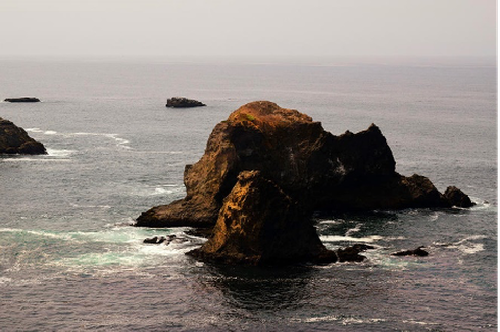
- It is an underwater mountain formed through volcanic activity.
- These are recognised as hotspots for marine life. Like volcanoes on land, seamounts can be active, extinct or dormant volcanoes.
- These are formed near mid-ocean ridges, where the earth’s tectonic plates are moving apart, allowing molten rock to rise to the seafloor.
- The planet’s two most-studied mid-ocean ridges are the Mid-Atlantic Ridge and the East Pacific Rise.
- Some seamounts have also been found near intraplate hotspots – regions of heavy volcanic activity within a plate – and oceanic island chains with a volcanic and seismic activity called island arcs.
- Significance of seamounts
- They provide information about the mantle’s composition and how tectonic plates evolve.
- Oceanographers also study seamounts to understand their influence on how water circulates and absorbs heat and carbon dioxide.
- Seamounts are home to diverse biological communities. They are good places for life because they can cause localised ocean upwelling – the process by which nutrient-rich water from deep within the ocean moves up to the surface.
Key Facts about the Mid-Atlantic Ridge
- It is the largest geological feature on the planet.
- It is a mostly underwater mountain range in the Atlantic Ocean.
- It is about 3 km in height above the ocean floor and 1000 to 1500 km wide, has numerous transform faults and an axial rift valley along its length.
- It separates the North American Plate from the Eurasian Plate in the North Atlantic and the South American Plate from the African Plate in the South Atlantic
About Anji Khad Bridge:
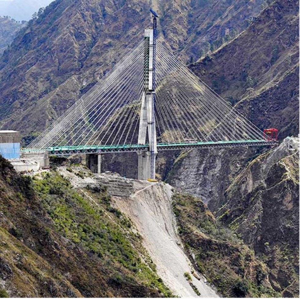
- It is an under-construction rail bridge in Jammu & Kashmir on the Indian Railways Jammu – Baramulla rail line.
- It will connect the Union Territory of Kashmir with the rest of the country by train.
- It is constructed over the Anji River, a tributary of the Chenab River between Katra and Reasi.
- Anji Khad Bridge will be the first cable-stayed railway bridge in the country.
- It is an asymmetrical cable-stayed bridge balanced on the axis of a central pylon.
- The total length of the structure is 25 metres.
- It stands at a height of 331 meters above the river bed.
- The bridge has a single-line railway track and a 3.75-metre-wide service road.
- The project is being executed by Konkan Railway Corporation Limited (KRCL) and Hindustan Construction Company.
Why in News?
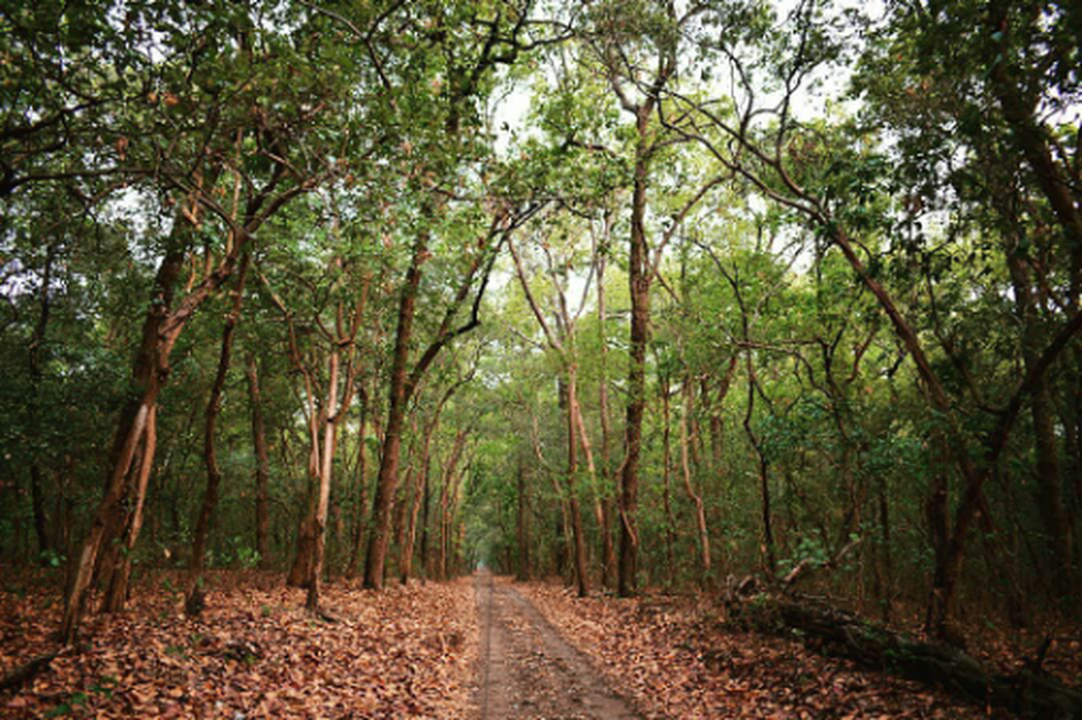
- The last sighting of a tiger in the Kalesar area was in 1913. Thus, the recent sight of the tiger in the Kalesar area is after a gap of 110 years.
About Kalesar National Park:
- Location:
- It is located in Yamunanagar District of Haryana.
- It is situated in the foothills of the Shiwalik ranges of the Himalayas.
- It was declared a National Park on 8th December 2003.
- Boundaries:
- River Yamuna lies to its east.
- Rajaji National Park, which is located in Uttrakhand, lies to the northeast of the park.
- Simbalbara National Park nestled in Shivalik Hills lies to the north, sharing a border with Himachal Pradesh.
- Morni Hills lies to the west.
- The park was named after a temple (known as Kalesar Mahadev temple) located inside the premise of the park.
- In earlier times, rulers under the Mughal and British Raj used the now park as hunting grounds.
- The park is also famous for its Dak bungalows – the administrative architectural bungalows built in colonial times.
- Flora:
- Most of the forest is covered by tall and dense sal trees.
- Other trees that are found in the forest are Semul, Bahera, Amaltas, Shisham, Khair, Sain, Chhal and Jhingan.
- Fauna: It houses many threatened animals like leopards, Ghoral, Barking deer, Sambar, Chital, Python, King Cobra, Monitor lizard etc
About Gulf of Oman:
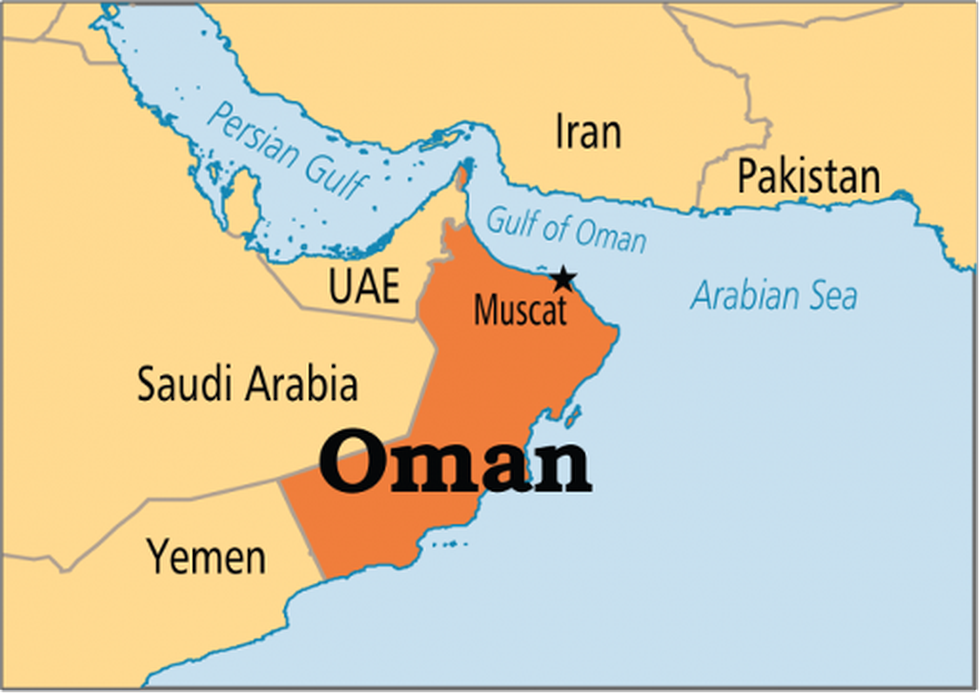
- The Gulf of Oman or Sea of Oman, also known as the Gulf of Makran or Sea of Makran, forms the only entrance to the Persian Gulf from the Indian Ocean.
- It connects the Arabian Sea with the Strait of Hormuz, which then empties into the Persian Gulf.
- Bordering Countries: It is bordered by Pakistan and Iran in the north, by the United Arab Emirates in the west and by Oman in the south.
- The gulf is relatively shallow because of its origin as a fissure in the mountain spine now divided between Iran and Oman.
- The Gulf of Oman is about 320 km wide at its widest point between Cape al-Hadd in Oman and Gwadar Bay on the Iran-Pakistan border. It narrows to 35 miles (56 km) at the Strait of Hormuz.
- It is approximately 560 km long.
- Some of the significant islands that are located in the Gulf of Oman include Sheytan Island, Al Fahal Island, Dimaniyat Islands, and the Sawadi Islands.
- The major international shipping ports that are situated in the Gulf of Oman include Port Sultan Qaboos Muttrah in Muscat, Oman; Chabahar Port in Iran; the Port of Fujairah and Khor Fakkan Container Terminal in the United Arab Emirates.
- Roughly one-third of the world's oil is exported via the Strait of Hormuz and the Gulf of Oman.
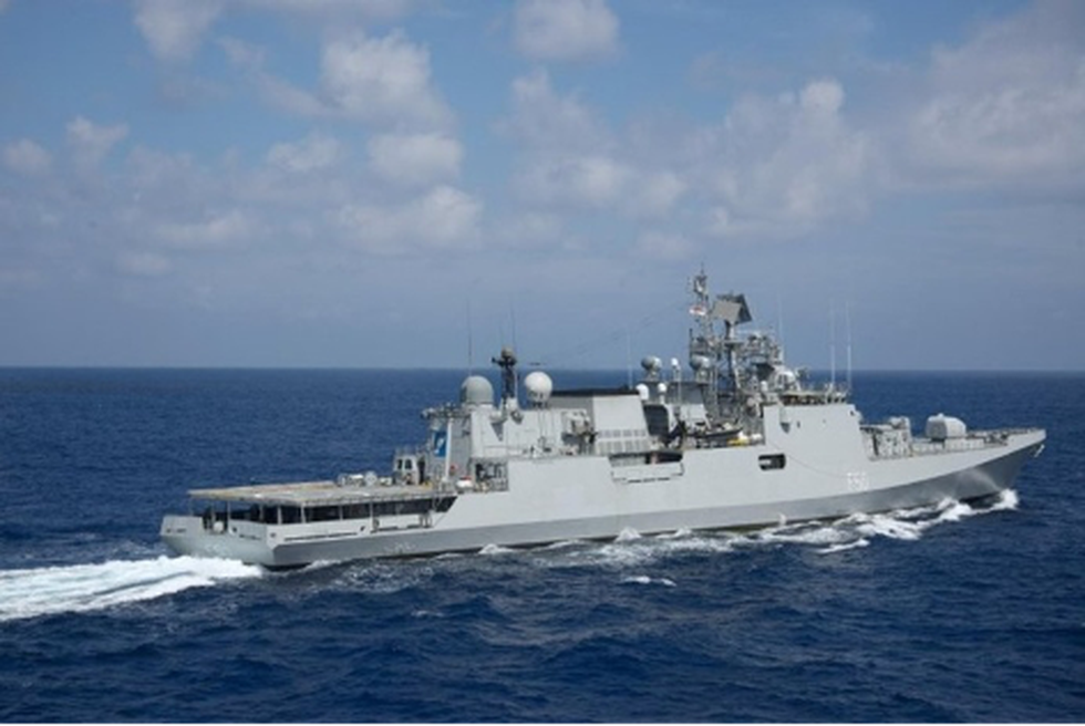
About INS Tarkash:
- It is a state-of-the-art stealth frigate of the Indian Navy equipped with a versatile range of weapons.
- Tarkash belongs to the Talwar class of guided missile frigates. These are modified Krivak III class frigates built by Russia.
- It was built by the Yantar shipyard in Kaliningrad, Russia.
- It was commissioned into Indian Navy service on 9 November 2012 at Kaliningrad and joined the Western Naval Command on 27 December 2012.
- Features:
- It has a length of 124.8 m, a beam of 15.2 m, and a draught of 4.2 m (13 ft 9 in).
- Top Speed: 32 knots (59 km/h; 37 mph).
- It has been equipped with a weapon sensor that enables it to address threats in all dimensions.
- It uses stealth technologies and a special hull design to ensure a reduced radar cross-section.
- It can board one Ka-28 Helix-A antisubmarine helicopter or one Ka-31 Helix-B airborne early warning helicopter,
- It is also equipped with BrahMos missiles instead of the Klub-N missiles, which makes it different from the earlier flight of Talwar-class ships.
Key Facts about “Operation Kaveri”:
- It is a rescue operation being carried out by the Indian Government to bring back Indian citizens stranded in Sudan.
- According to the official data, the number of Indians in Sudan is around 4,000.
- Why the need for evacuation? Sudan has been witnessing deadly fighting between the country's army and a paramilitary group, the paramilitary Rapid Support Forces (RSF), that has reportedly left several hundred’s dead.
- Cause of fighting? It was triggered by disagreement over an internationally backed plan to form a new civilian government four years after the fall of autocrat Omar al-Bashir and two years after the military coup. Both sides accuse the other of thwarting the transition.
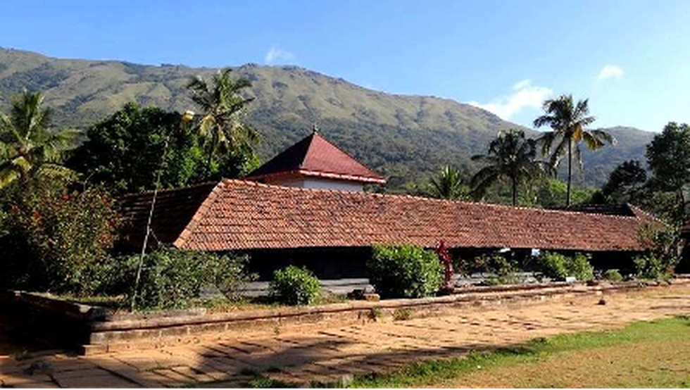
About Thirunelly Temple:
- It is an ancient temple dedicated to the Lord Maha Vishnu.
- Location: It is located on the sides of Brahmagiri Hill, a part of the Sahyadri Mountain Ranges in the Wayanad district of Kerala.
- It is also known as the Sahyamala Kshetram and Kashi of the South.
- It is the only temple in the world where the devotees can perform all the rituals related to one’s life, starting from birth to death and life after death.
- The rituals in this temple are performed on the banks of stream Papanashini, which originates from the Brahmagiri hills.
- Legend behind:
- It’s an ancient temple where Lord Brahma is said to establish the idol of Lord Vishnu.
- It’s believed that he found the idol on a gooseberry (amla) tree, locally known as nelli, thus giving Thirunelli its name.
- Architecture:
- The temple embodies classical, traditional Kerala architecture.
- The shrine is shielded with 30 granite columns, and the ground is paved with huge square pieces of granite.
- The inner sanctum is surrounded by a tile-roofed structure, and there is an open courtyard around the Sanctorum.
- Along the outer wall of the temple is a cloister made of granite pillars cut in cubical style.
- The main deity idol of the temple is in the form of Chathurbhuja - Lord Vishnu with his four hands.
Indian National Trust for Art and Cultural Heritage (INTACH):
- INTACH is an autonomous non-governmental Indian non-profit society that seeks to preserve Indian culture and heritage.
- It was founded in 1984 with the vision to spearhead heritage awareness and conservation in India.
- Headquarters: New Delhi
- It operates through various divisions such as Architectural Heritage, Natural Heritage, Material Heritage, Intangible Cultural Heritage, Heritage Education and Communication Services (HECS), Crafts and Community Cell, Chapters, INTACH Heritage Academy, Heritage Tourism, Listing Cell and Library, Archives and Documentation Centre.
Why in the news?
- The Union Territory of Chandigarh Forest and Wildlife Department has declared its 2.0 to 2.75 km area as ESZ of the sanctuary, it expects a similar area of ESZ from Haryana and Punjab.
- Although the two states have only agreed to declare merely 100 metres of their area as ESZ, their proposals are pending before the Ministry of Environment, Forest and Climate Change (MoEFCC).
- Supreme Court ruled that each national park and wildlife sanctuary must have an eco-sensitive zone (ESZ) of a minimum of 1 km, measured from the demarcated boundary of such protected forest.
About Sukhna wildlife sanctuary
- It is located in the Chandigarh Union Territory.
- It forms the part of Sukhna Lake catchment area falling in Shivalik hills.
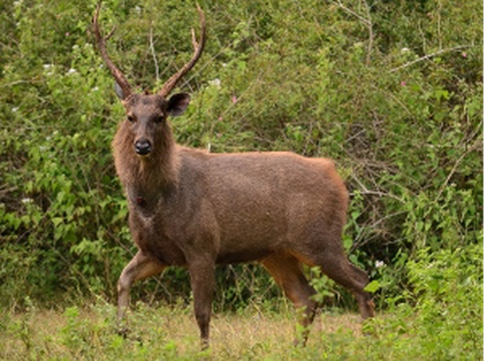
- Fauna: Sambar deer, Barking deer, and wild boar, as well as several species of birds, reptiles, and amphibians.
- Flora: The sanctuary is characterized by a mix of forests, grasslands, and wetlands, with the Sukhna Lake forming an important part of the ecosystem.
Key Facts about Shivalik Hills
- It is also called Siwalik Range or Outer Himalayas.
- It extends for more than 1,000 miles (1,600 km).
- It has an average elevation of 3,000 to 4,000 feet (900 to 1,200 metres).
- It rises abruptly from the plain of the Indus and Ganges (Ganga) rivers (south) and parallels the main range of the Himalayas (north), from which it is separated by valleys.
9. Hemis Monastery
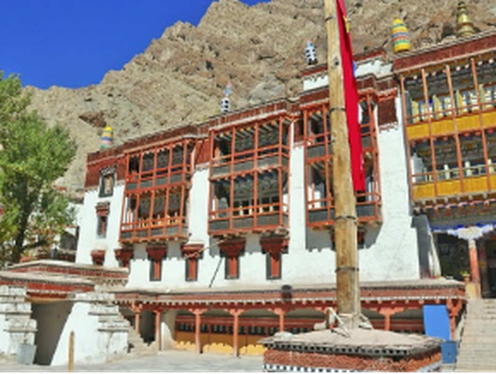
About Hemis Monastery:
- It is a Buddhist monastery located in Leh City,
- It belongs to the Drukpa lineage of Buddhism.
- The monastery was first established in the 11th century and later re-established in the 17th century by the Ladakhi King Sengge Namgyal.
- It is also famous for its 2-day religious ceremony known as the Hemis Festival.
- This festival is celebrated in honour of Padmasambhava which is observed here in
- It is the biggest and very richly endowed monastery.
Key Facts about the Drukpa Lineage Buddhism
- It was founded in the 12th century by Gyalwa Gotsangpa, a disciple of the famous Tibetan master Phagmo Drupa.
- It is particularly prominent in Bhutan.
- This is known for its efforts to empower women, and their nuns are allowed to receive the same level of training and education as their male counterparts.
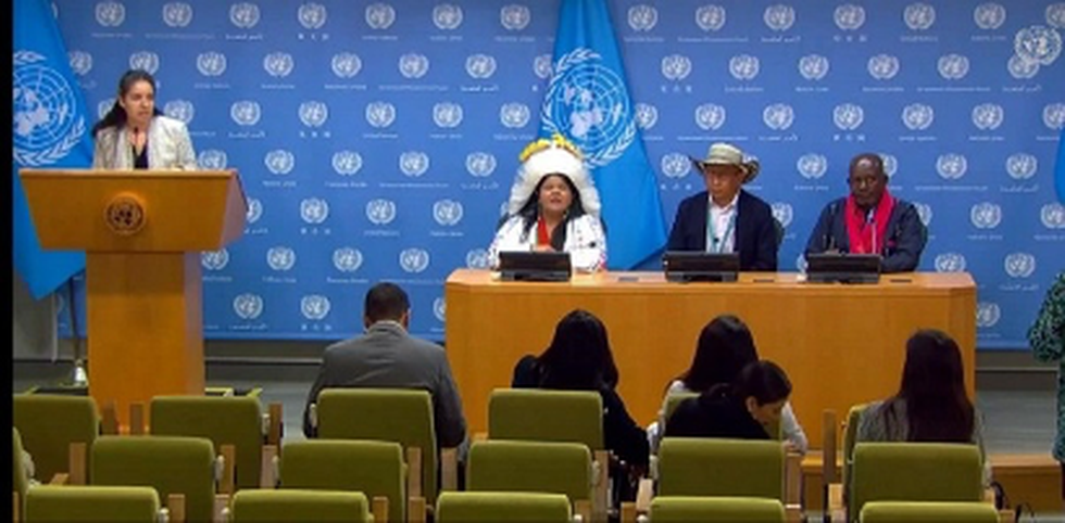
About UNPFII:
- It is a high-level advisory body to the Economic and Social Council.
- It was established on 28 July 2000.
- Mandate:To deal with indigenous issues related to economic and social development, culture, the environment, education, health and human rights.
- The first meeting of the Permanent Forum was held in May 2002, with yearly sessions thereafter.
- It is one of three UN bodies that is mandated to deal specifically with indigenous peoples’ issues.
- The others are the Expert Mechanism on the Rights of Indigenous Peoplesand the Special Rapporteur on the Rights of indigenous peoples.
Who are Indigenous Peoples?
- Indigenous peoples have in common a historical continuity with a given region before colonization and a strong link to their lands.
- They maintain, at least in part, distinct social, economic and political systems.
- They have distinct languages, cultures, beliefs and knowledge systems.
- They are determined to maintain and develop their identity and distinct institutions and they form a non-dominant sector of society.


.png)
.png)
.png)
.png)
.png)


.png)
.png)
.png)


.png)
.png)


.png)
.png)
.png)
.png)
.png)
.png)
.png)
.png)
.png)

.png)


.png)
.png)


.png)
.png)
.png)


.png)

.png)
.png)


.jpg)

.png)
.png)


.png)

.png)
.png)
.png)

.jpg)

.jpg)


.png)

.png)
.png)
.png)
.png)
.png)
.png)
.png)
.png)
.png)
.png)


.png)

.png)


.png)
.png)
.png)
.png)
.png)
.png)
.png)
.png)
.png)
.png)
.jpg)
.jpg)

.png)
.png)
.png)
.png)
.png)
.png)
.png)
.png)
.png)
.png)
.png)
.png)
.png)
.png)
.png)
.png)
.png)
.png)
.png)
.png)
.png)
.png)


.png)
.png)

.jpg)
.jpg)


.jpg)
.jpg)
.jpg)
.jpg)
.jpg)

.jpg)


.jpg)
.jpg)
.jpg)
.jpg)
.jpg)


.jpg)
.jpg)


.jpg)


.jpg)
.jpg)


.jpg)
.jpg)


.jpg)

.jpg)


.jpg)


.jpg)


.jpg)


.jpg)


.jpg)


.jpg)


.jpg)
.jpg)
.jpg)


.jpg)

.jpg)
.jpg)


.jpg)


.jpg)
.jpg)


.jpg)


.jpg)


.jpg)


.jpg)
.jpg)
.jpg)

.jpg)
.jpg)
.jpg)
.jpg)

.jpg)
.jpg)
.jpg)

.jpg)
.jpg)
.jpg)
.jpg)
.jpg)
.jpg)
.jpg)
.jpg)

.jpg)


.jpg)
.jpg)
.jpg)
.jpg)
.jpg)
.jpg)
.jpg)
.jpg)
.jpg)
.jpg)


.jpg)
.jpg)


.jpg)
.jpg)
.jpg)


.jpg)


.jpg)


.jpg)
.jpg)


.jpg)
.jpg)


.jpg)
.jpg)
.jpg)
.jpg)
.jpg)

.jpg)
.jpg)
.jpg)
.jpg)
.jpg)


.jpg)
.jpg)
.jpg)
.jpg)
.jpg)

.jpg)
.jpg)
.jpg)
.jpg)
.jpg)
.jpg)
.jpg)
.jpg)
.jpg)
.jpg)
.png)

.png)
.png)

.png)
.png)
.png)
.png)


.jpg)
.jpg)

.jpg)
.jpg)
.jpg)

.png)
.png)
.png)
.png)
.png)
.png)
.png)

.png)
.png)
.png)
.png)
.png)
.png)
.png)
.png)
.png)
.png)


-min.png)


.png)


.png)


