
Why in the news?
- The new lines included abstract humanoids, "decapitated heads," domesticated animals, fish, birds, cats, a potential "ceremonial scene" and human/animal interactions.
- The most bizarre shape was arguably a 72-foot-long (22 meters) "killer whale holding a knife."
- The staggering new haul was unearthed in just six months with the help of artificial intelligence (AI) and almost doubles the number of known geoglyphs in the region.
What are Nazca Lines?
- The Nazca Lines are a group of large human-carved geoglyphs located in a roughly 170-square-mile (440 square kilometres) area of Peru's Nazca Desert.
- The ancient artworks were likely created between 200 B.C. and A.D. 500 by members of the pre-Incan civilisation, known as the Nazca (or Nasca), who removed the upper layers of the desert's red-tinged surface pebbles to reveal sections of lighter soil in a wide range of different shapes and sizes.
- Researchers had already found around 430 Nazca Lines since the mysterious shapes were rediscovered by aeroplane passengers in the 1920s.
- Most of these geoglyphs were identified in the last 20 years with the help of advancements in satellite imagery.
2. Exostoma sentiyonoae

About Exostoma sentiyonoae:
- According to the research paper, the species can be distinguished by several unique characteristics including an adipose fin attached to the upper procurrent caudal-fin rays, tubercles on the dorsal-fin spine, a slender head, a long distance between the dorsal and adipose fins, small eyes and 41 vertebrae.
- The researchers distinguished Exostoma sentiyonoae from its congeners in the Salween drainage of Myanmar and Thailand, specifically E. berdmorei and E. gaoligongense.
- sentiyonoae differs from E. berdmorei in having a shorter dorsal-fin base, a longer dorsal-adipose distance, and a smaller eye and compared to E. gaoligongense, the new species has a shorter pectoral-pelvic distance and a smaller eye.
- It marks the fourth species of Exostoma described from the Barak drainage, highlighting the region’s rich biodiversity.
- It is the first known member of this genus discovered from the Dzuleke River in Nagaland.
The Bark system:
- The Barak is the second largest river in the Northeast India after the Brahmaputra.
- Origin: it originates as a small stream amidst the lofty hills covered by thick forests of Liyai village in the Poumai territory of Manipur.
- It has a length of about 900 km of which, 564 km fall in India.
- Drainage:
- The river runs through Manipur, Nagaland, Mizoram, Assam in India and Bangladesh.
- The stream is later joined by Deirii stream and Makhan stream as it flows down south through the Biiso valley.
- The Khiiri stream joins the Barak River before reaching Karong.
- After crossing the Maram region, the Barak flows southwards into the Zeme, Liangmai and Rongmei territories of Manipur and Nagaland.
- Finally, Barak flows into Bangladesh to join the Brahmaputra and Ganga.
3. Unified Logistics Interface Platform (ULIP)

Why in the news?
- Hackathon 2.0 is a competitive event, aimed at fostering innovation and developing digital solutions to tackle pressing challenges in the logistics industry.
- It invites developers, start-ups, and industry players to come together.
- The focus of this year's hackathon is on addressing key logistics challenges such as sustainability, complex supply chain processes, unified documentation, and multimodal logistics optimization.
About Unified Logistics Interface Platform:
- ULIP is a digital gateway that allows industry players to access logistics-related datasets from various Government systems through API-based integration.
- Currently, the platform integrates with 37 systems from 10 ministries via 118 APIs, covering over 1800 data fields.
- It was launched by the Prime Minister as part of the ‘National Logistics Policy (NLP)’ on September 17, 2022.
- objectives:
- To create a nationwide single window logistics platform for end-to-end visibility.
- To develop a logistics gateway by integrating information available with various Govt. agencies across the value chain.
- To provide visibility for optimal usage of various modes of transportation.
- To provide data which can be utilized by the stakeholders for simplification of complicated processes like compliance, document filing, certifications, and approvals.
- To offer a platform for data exchange among government and private entities who are directly or indirectly involved in the Indian Logistics ecosystem.
- Benefits:
- It will give direct and indirect benefits to all logistics stakeholders like verification of drivers and vehicle details, tracking & tracing of consignment, Route Optimization Planning and timely update on the destination of the consignment etc.
- It will enable structured planning by helping in decision making on optimum use of modes of logistics thereby saving cost and time.
4. Periodic Labour Force Survey
Key Findings:
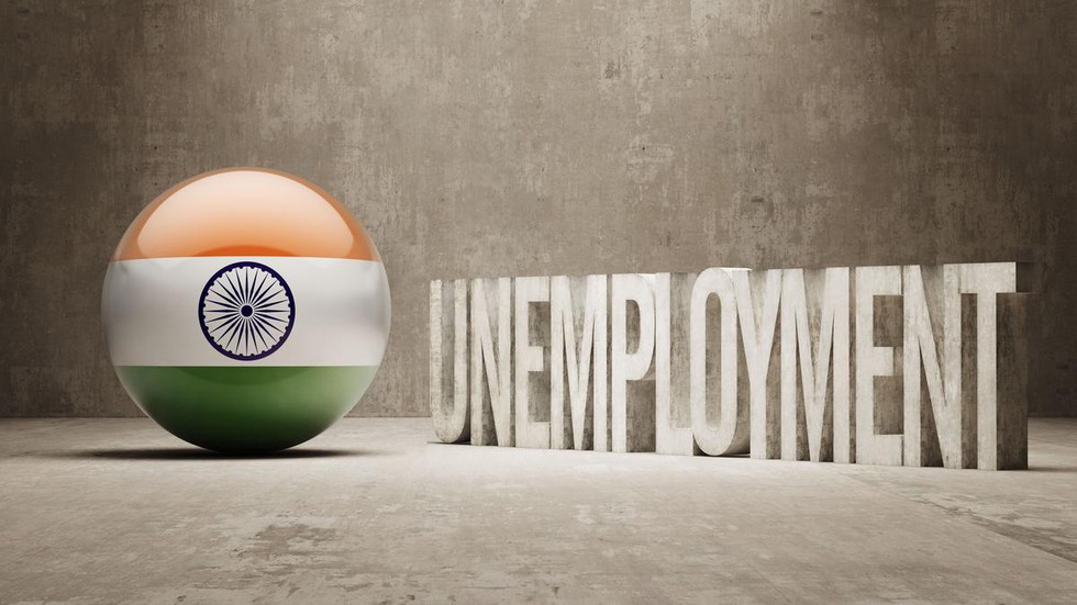
- Labour Force Participation Rate (LFPR) for persons of age 15 years and above was 60.1%. The same for male and female was 78.8% and 41.7% respectively.
- Worker Population Ratio (WPR) for persons of age 15 years and above was 58.2%. The same for male and female was 76.3% and 40.3% respectively.
- Unemployment Rate (UR) was 3.2% for both male and females of age 15 years and above.
- Unemployment Rate for male has shown a marginal decline from 3.3% during July 2022 – June 2023 to 3.2% during July 2023 – June 2024, among females it has increased from 2.9% to 3.2% during the same time span.
About Periodic Labour Force Survey (PLFS):
- Considering the importance of availability of labour force data at more frequent time intervals, the National Statistical Office (NSO) launched the Periodic Labour Force Survey in April 2017.
- Objective:
- To estimate the key employment and unemployment indicators (viz. Worker Population Ratio, Labour Force Participation Rate, Unemployment Rate) in the short time interval of three months for the urban areas only in the ‘Current Weekly Status’ (CWS).
- To estimate employment and unemployment indicators in both ‘Usual Status’ (ps+ss) and CWS in both rural and urban areas annually.
- The indicators of this survey are defined as follows:
- Labour Force Participation Rate (LFPR): LFPR is defined as the percentage of persons in labour force (i.e. working or seeking or available for work) in the population.
- Worker Population Ratio (WPR): WPR is defined as the percentage of employed persons in the population.
- Unemployment Rate (UR): UR is defined as the percentage of persons unemployed among the persons in the labour force.
- Current Weekly Status (CWS): The activity status determined on the basis of a reference period of last 7 days preceding the date of survey is known as the current weekly status (CWS) of the person.
- This survey is conducted by the National Sample Survey (NSO), working under the Ministry of Statistics and Programme Implementation (MoSPI).
5. Eturnagaram Wildlife Sanctuary
- Location:
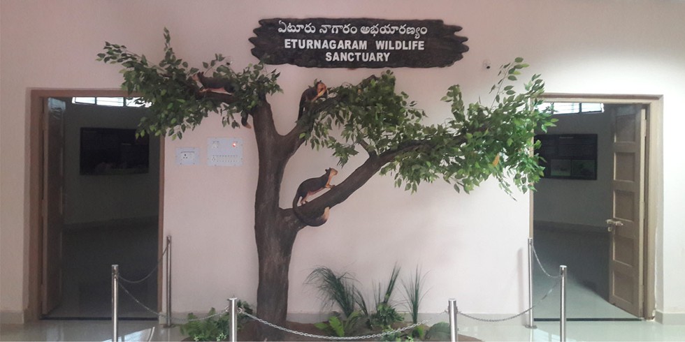
- Eturnagaram Wildlife Sanctuary is located near the border of Maharashtra, Chhattisgarh and Telangana in the village of Eturnagaram, a tribal village in Mulugu district of Telangana.
- It is located 100 km from Warangal and 250 km from Hyderabad.
- It was declared as a wildlife sanctuary in 1952 by Hyderabad Nizam Government.
- It is spread over an area of around 806 sq. km.
- River:
- It has a water source called Dayyam Vagu, which separates the sanctuary into two parts.
- River Godavari also passes through it.
- Flora:
- The region is covered completely with thick natural vegetation and it falls in the tropical dry deciduous.
- It is rich in the growth of teak, bamboo and other trees like madhuca and terminalia.
- Fauna:
- This sanctuary provides shelter to Tiger, Leopard, Panther, Wolf, Wild Dogs, Jackals, Sloth Bear, Chousingha, Black Buck, Nilgai, Sambar, Spotted Deer and Four Horned Antilope etc.
- The plethora of water in the sanctuary is attributed to the presence of reptiles like the famous Mugger crocodiles and snakes like the Cobra, Python and Krait.
- The famous Sammakka-Saralamma Temple is situated inside the sanctuary.
6. Taiwan Strait
About Taiwan Strait:
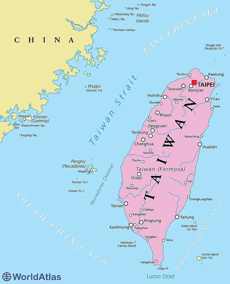
- It is also called Formosa Strait which separates the island of Taiwan and continental Asia.
- Ports: The chief ports are Amoy in mainland China and Kao-hsiung in Taiwan.
- Rivers: Several rivers including the Jiulong and Min rivers from China’s Fujian Province drain into the Taiwan Strait.
- The biggest islands along the Taiwan side include Penghu (or Pescadores), Xiamen, and Pingtan.
- The Taiwan Strait constitutes a critical corridor connecting the South China Sea to the East China Sea and also serves as a busy navigational waterway, on which millions of tons of cargo are ferried annually.
- The strait is also one of the most important fishing grounds in China and more than a hundred economically important fish species are found here.
What is a strait?
- A strait is a narrow body of water that connects two larger bodies of water.
- A strait is similar to a canal cutting through an isthmus (a narrow strip of land), but a strait is formed naturally and canals are built by people.
- Significance: Straits are often important transportation routes since they allow ships to pass from one body of water to another.
7. Asia Power Index
About Asia Power Index:
- It was launched by the Lowy Institute in 2018.
- It is an annual measure of power dynamics in the Asia-Pacific region.
- It evaluates 27 countries across the Asia-Pacific, examining their ability to shape and respond to the external environment.
- The Index focuses on both the material capabilities of states and the influence they exert on the international stage.
- The 2024 edition offers one of the most comprehensive assessments of power distribution in the region to date. Timor-Leste has been included for the first time, reflecting its growing importance in Southeast Asia.
- It index is divided into resource-based and influence-based determinants
- Resource-Based Determinants:
- Economic Capability: The core economic strength of a country, measured through indicators like GDP at purchasing power parity (PPP), technological sophistication, and global economic connectivity.
- Military Capability: Evaluates conventional military strength based on defense spending, armed forces, weapon systems, and signature capabilities like long-range power projection.
- Resilience: The internal capacity to deter threats to state stability, including institutional robustness, geopolitical security, and resource security.
- Future Resources: Forecasts the future distribution of resources, including economic, military, and demographic factors projected for 2035.
- Influence-Based Determinants:
- Economic Relationships: The capacity to exercise leverage through trade, investment, and economic diplomacy.
- Defense Networks: The strength of alliances and partnerships, measured through military cooperation and arms transfers.
- Diplomatic Influence: The extent of a country's diplomatic reach, participation in multilateral forums, and foreign policy ambition.
- Cultural Influence: The ability to shape international public opinion through cultural exports, media, and people-to-people ties.
- A country's overall power score is derived from a weighted average of these eight measures, encompassing 131 individual indicators.
8. What is Infrasound?
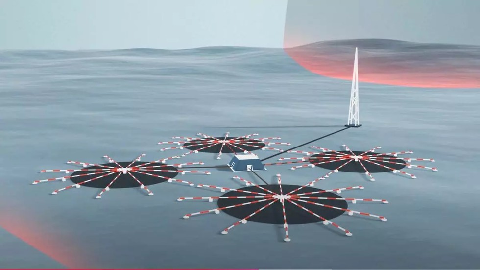
About Infrasound:
- It refers to sound waves with very low frequencies, in contrast to the more ubiquitous ultrasound.
- It can be produced by a passing meteor, a storm, an aurora up north, volcanoes, earthquakes or even nuclear explosions.
- Infrasonic waves can cause minute changes in the atmospheric pressure, which can be measured by micro barometers.
- These noiseless sounds can travel very long distances without losing steam — a property that CTBTO finds useful for detecting distant nuclear explosions.
- The CTBTO’s International Monitoring System (IMS) uses a range of technologies to detect nuclear explosions. Its Infrasound Network (that is being built) is the only global monitoring network of its kind, with plans to build a network of 60 array stations in 35 countries.
- Applications of Infrasound
- It can be used to check the structural health of buildings, dams or bridges — because infrasonic waves can pass through dense materials and reveal internal stress, cracks or other defects.
- In the field of aerospace, low-frequency sounds generated during a rocket’s lift-off can cue the stress and behaviour of a rocket, or detect aerodynamic instabilities of an aircraft.
- In mining, infrasound can help check the integrity of mine shafts or determine whether a dynamite blast was successful.
- This sound has also been used in wildlife tracking, such as monitoring the movement of whales.
9. What is the Minerals Security Finance Network?

About Minerals Security Finance Network:
- It is a new initiative emerging from the Minerals Security Partnership (MSP).
- It is aimed at strengthening global cooperation in securing critical mineral supply chains.
- The network brings together institutions from the Indo-Pacific region and Europe, promoting cooperation, information exchange, and co-financing.
- Member countries: The partnership includes 13 countries and the European Commission.
- These are the United States of America, Australia, Canada, Estonia, Finland, France, Germany, India, Italy, Japan, the Republic of Korea, Norway, Sweden, the United Kingdom, and the European Union (represented by the European Commission).
- Significance to India: It helps India in diversifying and securing its supply of critical minerals from nations like Argentina, Chile, Australia, and select African countries. Kazakhstan, in Central Asia, is also being explored as a potential source for India’s mineral requirements.
Key facts about the Minerals Security Partnership
- It is a framework established by the US in 2022.
- It is an ambitious new initiative to bolster critical mineral supply chains, announced by the United States (US) and key partner countries in June 2022.
- The goal of the alliance is to ensure that critical minerals are produced, processed, and recycled in a manner that supports the ability of countries to realise the full economic development benefit of their geological endowments.
- The focus of the grouping would be on the supply chains of minerals such as Cobalt, Nickel, Lithium and also the 17 “rare earth” minerals.
- India was inducted to the MSP in June 2023.
- Significance of Critical minerals: These minerals are vital for the production of renewable energy technologies such as electric vehicle batteries, solar panels, and wind turbines, have become essential components of the global shift towards clean energy.
10. Women in Space Leadership Programme

About Women in Space Leadership Programme:
- This initiative aims to develop a women’s leadership framework to support institutions in strengthening their gender-inclusive practices and policies, specifically around space sciences and allied areas.
- It fosters women’s leadership in space sciences by developing a strategic leadership framework. Under this initiative Coventry University acts as the delivery partner.
- To promote a more equitable distribution of leadership opportunities and enable a workplace culture that recognises female leaders, this programme is underpinned by three foundational pillars:
- Intersectionality or understanding of different aspects of women’s identities
- Collaborative culturally sensitive approaches that respond to opportunities and challenges in India
- Using leadership theory from both social science and STEM to support female scientists to become more confident about their leadership abilities
What is UK-India Education and Research Initiative (UKIERI)?
- It is the UK and India’s flagship bilateral collaboration programme on education and research founded in 2006.
- Objective: By strengthening education and research collaboration between the UK and India, UKIERI helps both countries to achieve their knowledge ambitions.
- UKIERI has been implemented in three phases from 2006 to 2022. The fourth phase of UKIERI was launched in 2023.
- UKIERI Phase 4 expects to strengthen the bilateral relationship between the UK and India in the areas of education, research, and innovation, while addressing shared global challenges and promoting sustainable development.






.png)
.png)
.png)
.png)
.png)


.png)
.png)
.png)


.png)
.png)


.png)
.png)
.png)
.png)
.png)
.png)
.png)
.png)
.png)

.png)


.png)
.png)


.png)
.png)
.png)


.png)

.png)
.png)


.jpg)

.png)
.png)


.png)

.png)
.png)
.png)

.jpg)

.jpg)


.png)

.png)
.png)
.png)
.png)
.png)
.png)
.png)
.png)
.png)
.png)


.png)

.png)


.png)
.png)
.png)
.png)
.png)
.png)
.png)
.png)
.png)
.png)
.jpg)
.jpg)

.png)
.png)
.png)
.png)
.png)
.png)
.png)
.png)
.png)
.png)
.png)
.png)
.png)
.png)
.png)
.png)
.png)
.png)
.png)
.png)
.png)
.png)


.png)
.png)

.jpg)
.jpg)


.jpg)
.jpg)
.jpg)
.jpg)
.jpg)

.jpg)


.jpg)
.jpg)
.jpg)
.jpg)
.jpg)


.jpg)
.jpg)


.jpg)


.jpg)
.jpg)


.jpg)
.jpg)


.jpg)

.jpg)


.jpg)


.jpg)


.jpg)


.jpg)


.jpg)


.jpg)


.jpg)
.jpg)
.jpg)


.jpg)

.jpg)
.jpg)


.jpg)


.jpg)
.jpg)


.jpg)


.jpg)


.jpg)


.jpg)
.jpg)
.jpg)

.jpg)
.jpg)
.jpg)
.jpg)

.jpg)
.jpg)
.jpg)

.jpg)
.jpg)
.jpg)
.jpg)
.jpg)
.jpg)
.jpg)
.jpg)

.jpg)


.jpg)
.jpg)
.jpg)
.jpg)
.jpg)
.jpg)
.jpg)
.jpg)
.jpg)
.jpg)


.jpg)
.jpg)


.jpg)
.jpg)
.jpg)


.jpg)


.jpg)


.jpg)
.jpg)


.jpg)
.jpg)


.jpg)
.jpg)
.jpg)
.jpg)
.jpg)

.jpg)
.jpg)
.jpg)
.jpg)
.jpg)


.jpg)
.jpg)
.jpg)
.jpg)
.jpg)

.jpg)
.jpg)
.jpg)
.jpg)
.jpg)
.jpg)
.jpg)
.jpg)
.jpg)
.jpg)
.png)

.png)
.png)

.png)
.png)
.png)
.png)


.jpg)
.jpg)

.jpg)
.jpg)
.jpg)

.png)
.png)
.png)
.png)
.png)
.png)
.png)

.png)
.png)
.png)
.png)
.png)
.png)
.png)
.png)
.png)
.png)


-min.png)


.png)


.png)


