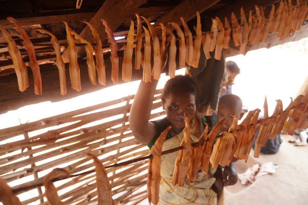
About Konda Reddi Tribe:
- Konda Reddis is a Particularly Vulnerable Tribal Group inhabiting the banks of the river Godavari and also in the hilly forest tracts of Godavari and Khammam districts of Andhra Pradesh.
- Their mother tongue is Telugu, with a unique accent.
- Subdivisions:
- The Konda Reddy tribe is divided into exogamous septs for regulating matrimonial relations.
- Like other Telugu-speaking people, their surnames are prefixed to individual names.
- Generally, each sept is exogamous, but certain septs are considered as brother septs and marriage alliances with brother septs (agnate relations) are prohibited.
- Family and Marriage:
- The family is patriarchal and patrilocal. Monogamy is a rule, but polygamous families are also found.
- Marriage by negotiations, by love and elopement, by service, by capture and by exchange are socially accepted ways of acquiring mates.
- Religion: The primary religion practiced by the Konda Reddi is Folk Hinduism, characterized by local traditions and cults of local deities worshiped at the community level.
- Political Organization:
- They have their own institution of social control called ‘Kula Panchayat’.
- Each village has a traditional headman called ‘Pedda Kapu’.
- The office of the headman is hereditary, and the headman is also the Pujari (priest) of the village deities.
- Livelihood:
- They are primarily shifting cultivators and largely depend on flora and fauna of forest for their livelihood.
- They collect and sell non timber forest produce like tamarind, adda leaves, myrobolan, broom sticks, etc., to supplement their meagre income.
- They cultivate largely jowar, which is their staple food.
2. Onyx Missile
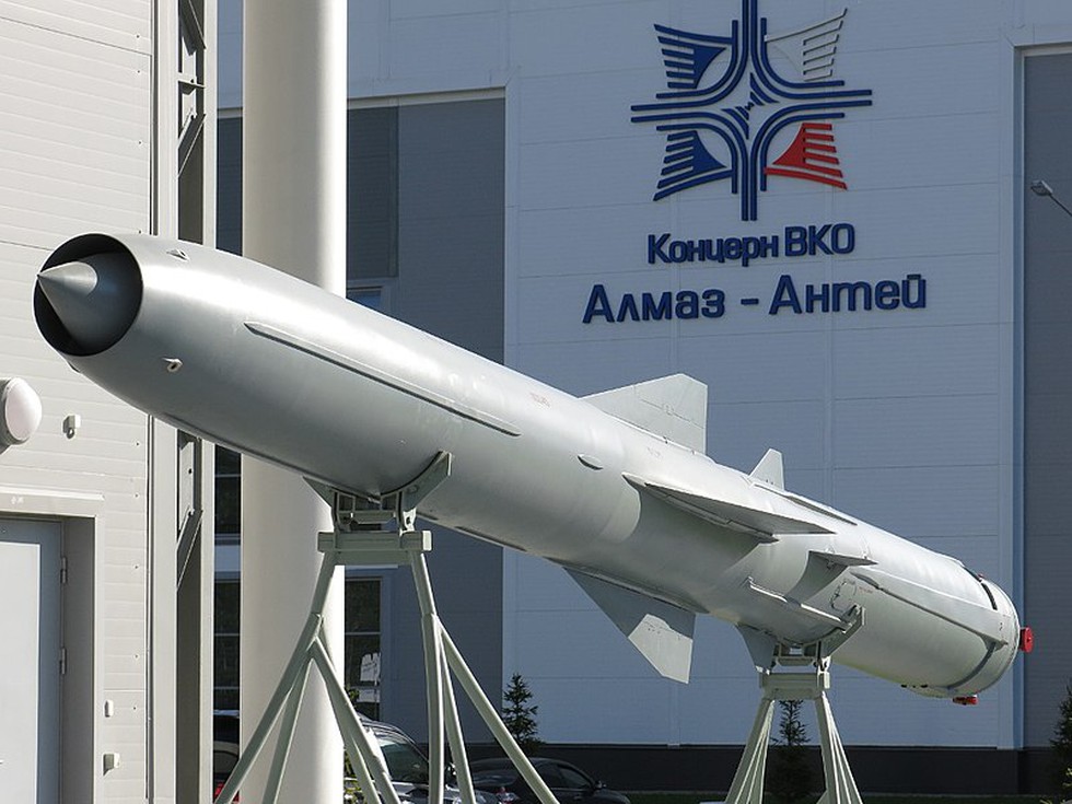
About Onyx Missile:
- The P-800 Onyx, a supersonic medium-range cruise missile, is designed to combat surface ship groups, as well as to destroy ground targets in conditions of strong fire and electronic countermeasures.
- Features:
- Also known as Russian Brahmos, it can reach speeds of over 3,000 km/h, making it extremely difficult to intercept.
- Additionally, the missile operates at an altitude of 10-15 meters above land or water, further enhancing its stealth capabilities.
- The missile has a range of up to 300 kilometers in its default trajectory and a range of 120 km in a low-altitude trajectory.
- It can be launched from surface ships, submarines and land-based equipment. It is a self-guided munition, designed with the "shoot and forget" principle in mind.
- Unlike some other missiles that rely on extensive target data, the Onyx missile requires minimal information about its target to strike it successfully.
3. Key Facts about Madagascar:
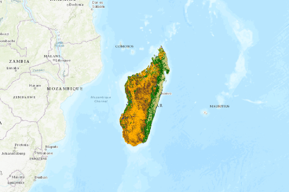
About Madagascar:
- Located off the coast of East Africa in the Indian Ocean, Madagascar is the second-largest island country in the world.
- It covers an area of 592,800 sq. kilometers.
- Geography: The country can be divided into three parallel longitudinal physiographic regions.
- The coastal strip in the east, the central plateau and the western regions of low plateaus and plains.
- The Tsaratanana Massif region at the northern end of the island is home to Madagascar's highest point, Maromokotro, at 2,876 m.
- History:
- France invaded the island in 1883. France officially declared Madagascar a French colony in 1896.
- After World War II, in 1947, locals fought for their independence from France in what became known as the Malagasy Uprising. In 1960, Madagascar finally became an independent nation.
- Capital: Antananarivo
- Languages: Malagasy, French
- Government: It is a semi-presidential republic. The public elects a president, who in turn appoints a prime minister to put together a cabinet to advise the president.
- Economy: Eighty percent of Madagascar’s economy is fueled by agricultural industries, including forestry and fishing. Among the island’s most frequently sold agricultural products are coffee, vanilla and sugarcane.
- Biodiversity:
- Lush rainforests, dry deserts, and grassy plains cover the island, with coral reefs and mangrove forests stretching along its coastlines.
- Almost 90 percent of the plants and animals living on Madagascar aren’t found anywhere else in the world. That’s because strong ocean currents have isolated the island from the African continent, so the species living there haven’t traveled beyond the island’s borders.
4. Central Pollution Control Board (CPCB)
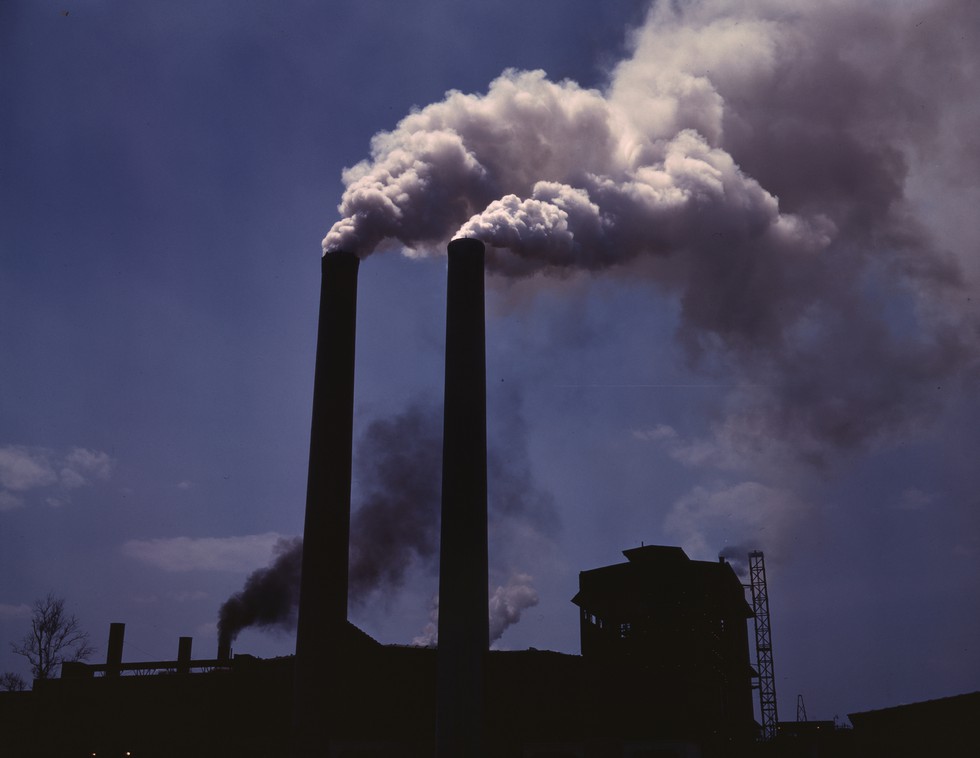
About Central Pollution Control Board (CPCB):
- It is a statutory organisation constituted in September 1974 under the Water (Prevention and Control of Pollution) Act, 1974.
- Further, CPCB was entrusted with the powers and functions under the Air (Prevention and Control of Pollution) Act, 1981.
- It provides technical services to the Ministry of Environment, Forests and Climate Change (MOEFCC) of the provisions of the Environment (Protection) Act, 1986 and advises the Central Government on any matter concerning the prevention and control of water and air pollution and the improvement of the quality of air.
- Principal Functions of the CPCB:
- to promote the cleanliness of streams and wells in different areas of the States by prevention, control, and abatement of water pollution
- to improve the quality of air and to prevent, control or abate air pollution in the country.
- Standardization activity of CPCB:
- CPCB lays down standards for streams or wells in consultation with the State Governments, and also lays down standards for the quality of air.
- CPCB also prepares manuals, codes, and guidelines relating to the treatment and disposal of sewage and trade effluents, as well as for stack gas cleaning devices, stacks, and ducts.
- In general, the following nine categories of standards are developed by CPCB:
- National ambient air quality
- Water Quality Criteria from different sources
- Standards for Emission or Discharge of Environmental Pollutants from various Industries (Issued under Environment Protection Rules, 1986)
- Standards for Treatment and Disposal of Bio-Medical waste by Incineration
- Guidelines for the disposal of Common Hazardous Wastes by Incineration
- Emission norms for vehicles
- Auto fuel quality
- Emission standard, Noise limits for Diesel Engines
- Emission & Noise Limit of LPG & CNG Generator Sets
- Apart from the above, under the Comprehensive Industry Document Series (COINDS), CPCB also formulates the Minimal National Standards (MINAS) specific for various categories of industries with regards to their effluent discharge (water pollutants), emissions (air pollutants), noise levels and solid waste. These standards are required to be adopted by State Governments as minimal standards.
5. Financial Action Task Force (FATF)

About Financial Action Task Force (FATF):
- It is an inter-governmental policy-making and standard-setting body dedicated to combating money laundering and terrorist financing.
- Objective: To establish international standards and to develop and promote policies, both at national and international levels, to combat money laundering and the financing of terrorism.
- Origin:
- It was established in 1989 during the G7 Summit in Paris to develop policies against money laundering.
- In 2001, its mandate was expanded to include terrorism financing.
- Headquarters: Paris, France.
- Its members include 39 countries, including the United States, India, China, Saudi Arabia, Britain, Germany, France and the EU as such.
- India became a member of FATF in 2010.
- What are FATF 'grey list' and 'blacklist'? FATF has 2 types of lists:
- Black List: Countries known as Non-Cooperative Countries or Territories (NCCTs) are put on the blacklist. These countries support terror funding and money laundering activities. The FATF revises the blacklist regularly, adding or deleting entries.
- Grey List: Countries that are considered a safe haven for supporting terror funding and money laundering are put on the FATF grey list. This inclusion serves as a warning to the country that it may enter the blacklist.
- Three countries North Korea, Iran and Myanmar are currently in FATF’s blacklist.
- Consequences of being on the FATF blacklist:
- No financial aid is given to them by the International Monetary Fund (IMF), the World Bank, the Asian Development Bank (ADB) and the European Union (EU).
- They also face a number of international economic and financial restrictions and sanctions.
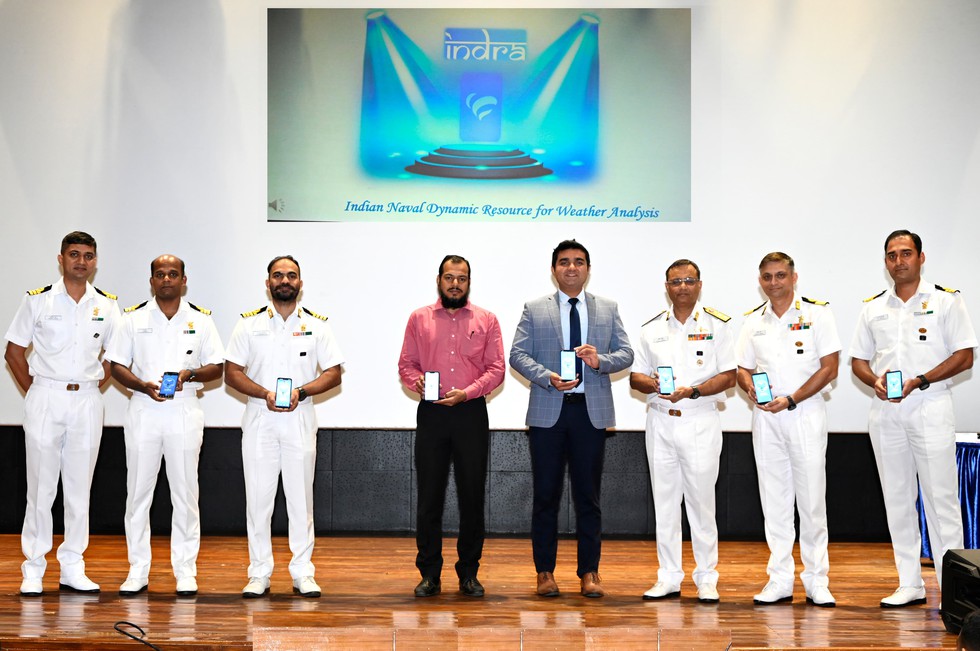
6. Recently, INDRRA app was launched as part of the World Meteorological Day celebrations.
About INDRA App:
- The Indian Naval Dynamic Resource for Weather Analysis (INDRA) app will help to disseminate weather related information and forecasts empowering optimal & quick decision making.
- The application has been developed by BISAG (Bhaskaracharya National Institute for Space Applications and Geo-informatics) in coordination with Directorate of Naval Oceanology and Meteorology, Indian Navy.
Key facts about BISAG
- It is an Autonomous Scientific Society registered under the Societies Registration Act, 1860.
- It undertakes technology development & management, research & development, facilitate National & International cooperation, capacity building and support technology transfer & entrepreneurship development in area of geo-spatial technology.
- The organisation has three main domain areas: Satellite Communication, Geo-informatics and Geo-spatial technology.
- Nodal Ministry: Ministry of Electronics & Information Technology (MeitY), Government of India.
7. International Rice Research Institute
About International Rice Research Institute:
- It is an independent, nonprofit, research and educational institute, founded in 1960 by the Ford and Rockefeller foundations with support from the Philippine government.
- It is the world’s premier research organization dedicated to reducing poverty, hunger, and malnutrition through rice science.
- It aims to improve the health and welfare of those who depend on rice-based agri-food systems and promote and protect the environmental sustainability of rice farming for future generations.
- IRRI's research for development is characterized by its collaborative nature: from alliances with advanced research institutes; through strong collaborations and capacity development with governments and national agricultural research and extension systems.
- The Government of India vide its Gazette notification recognises IRRI as an international organisation and accorded privileges and immunities (As per UN Privileges and Immunities Act 1947) that are applicable to United Nations (UN) organizations, for all offices and activities of IRRI in India including, for the IRRI South Asia Regional Centre.
- Headquarter: Los Banos, Philippines.
8. Vaikom Satyagraha
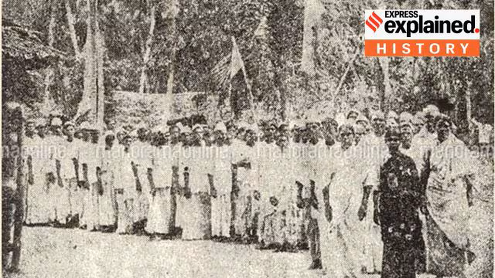
About Vaikom Satyagraha:
- It is the first anti-caste movement, as the pupil of the depressed class and untouchables were restricted from entering the temple.
- It was aimed to establish the rights of the oppressed classes to walk on the roads to the Shree Mahadeva Temple in Vaikom in Kottayam district.
- Background:
- The issue of temple entry was first raised by Ezhava leader TK Madhavan in a 1917 editorial in his paper Deshabhimani.
- In AICC (All India Congress Committee) meeting in Kakinada 1923, K Madhavan along with Sardar Panikkar and KP Kesava Menon submitted a petition to the Travancore legislative council.
- The petition sought to grant the right to temple entry and worship of gods for all sections of the society irrespective of caste, creed and community. The movement was launched on 30th March 1924.
- The movement in the vicinity of Mahadev temple in Kottayam district of Kerala took place during 1924-1925.
- Factors responsible to Satyagraha:
- Christian missionaries, supported by the East India Company, had expanded their reach and many lower castes converted to Christianity to escape the clutches of an oppressive system that continued to bind them.
- Maharaja Ayilyam Thirunal took many progressive reforms and the most important of these was the introduction of a modern education system with free primary education for all – even lower castes.
- Prominent people who supported this Satyagraha are Sree Narayana Guru and Periyar E.V Ramaswamy.
9. Fish otolith
About Fish otolith:
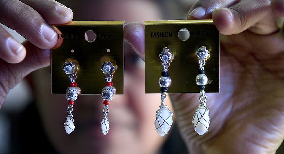
- Otoliths are biomineralised ear stones that help fish hear and provide it a sense of balance. These are important in fish studies as they have species-specific shapes and grow throughout their life.
- They are commonly known as "earstones," are hard, calcium carbonate structures located directly behind the brain of bony fishes.
- There are three types of otoliths, all of which aid fish in balance and hearing:
- Sagitta: It is involved in the detection of sound and the process of hearing or converting sound waves into electrical signals.
- Asteriscus: It is involved in the detection of sound and the process of hearing.
- Lapillus: It is involved in the detection of gravitational force and sound.
- Different species have otoliths of different shapes and sizes; and cartilaginous fishes, such as sharks, skates and rays, have none.
- Significance:
- These otoliths can be used to identify the species, size, age, growth rate, and season of death of an individual fish.
- Analysis of the oxygen isotope values of fish otoliths can provide information on the temperature of the water in which the fish lived.
10. UNESCO Global Geoparks Network
About UNESCO Global Geoparks Network:
- These are single, unified geographical areas where sites and landscapes of international geological significance are managed with a holistic concept of protection, education and sustainable development.
- The UNESCO Global Geopark designation was created in 2015 and recognizes “geological heritage of international significance”. These comprise a number of geological heritage sites of special scientific importance, rarity or beauty.
- The establishment of a UNESCO Global Geopark is a bottom-up process involving a strong local multiple partnership with long-term public and political support.
- It is not a formal legislative designation, though the defining geological heritage sites within a UNESCO Global Geopark must be protected under indigenous, local, regional or national legislation as appropriate.
- This status does not imply restrictions on any economic activity inside a UNESCO Global Geopark where that activity complies with indigenous, local, regional and/or national legislation.
- Recognition Period: A UNESCO Global Geopark is given this designation for a period of four years after which the functioning of the site re-examined during a revalidation process.
- Restrictions: The selling or destruction of the geological value of a UNESCO Global Geopark or of material either from within the Geopark or from anywhere else in the world is not permitted.
Global Geoparks Network:
- It is a non-profit International Association officially established in 2014 subject to French legislation. It is the official partner of UNESCO for the operation of the UNESCO Global Geoparks.





.png)
.png)
.png)
.png)
.png)


.png)
.png)
.png)


.png)
.png)


.png)
.png)
.png)
.png)
.png)
.png)
.png)
.png)
.png)

.png)


.png)
.png)


.png)
.png)
.png)


.png)

.png)
.png)


.jpg)

.png)
.png)


.png)

.png)
.png)
.png)

.jpg)

.jpg)


.png)

.png)
.png)
.png)
.png)
.png)
.png)
.png)
.png)
.png)
.png)


.png)

.png)


.png)
.png)
.png)
.png)
.png)
.png)
.png)
.png)
.png)
.png)
.jpg)
.jpg)

.png)
.png)
.png)
.png)
.png)
.png)
.png)
.png)
.png)
.png)
.png)
.png)
.png)
.png)
.png)
.png)
.png)
.png)
.png)
.png)
.png)
.png)


.png)
.png)

.jpg)
.jpg)


.jpg)
.jpg)
.jpg)
.jpg)
.jpg)

.jpg)


.jpg)
.jpg)
.jpg)
.jpg)
.jpg)


.jpg)
.jpg)


.jpg)


.jpg)
.jpg)


.jpg)
.jpg)


.jpg)

.jpg)


.jpg)


.jpg)


.jpg)


.jpg)


.jpg)


.jpg)


.jpg)
.jpg)
.jpg)


.jpg)

.jpg)
.jpg)


.jpg)


.jpg)
.jpg)


.jpg)


.jpg)


.jpg)


.jpg)
.jpg)
.jpg)

.jpg)
.jpg)
.jpg)
.jpg)

.jpg)
.jpg)
.jpg)

.jpg)
.jpg)
.jpg)
.jpg)
.jpg)
.jpg)
.jpg)
.jpg)

.jpg)


.jpg)
.jpg)
.jpg)
.jpg)
.jpg)
.jpg)
.jpg)
.jpg)
.jpg)
.jpg)


.jpg)
.jpg)


.jpg)
.jpg)
.jpg)


.jpg)


.jpg)


.jpg)
.jpg)


.jpg)
.jpg)


.jpg)
.jpg)
.jpg)
.jpg)
.jpg)

.jpg)
.jpg)
.jpg)
.jpg)
.jpg)


.jpg)
.jpg)
.jpg)
.jpg)
.jpg)

.jpg)
.jpg)
.jpg)
.jpg)
.jpg)
.jpg)
.jpg)
.jpg)
.jpg)
.jpg)
.png)

.png)
.png)

.png)
.png)
.png)
.png)


.jpg)
.jpg)

.jpg)
.jpg)
.jpg)

.png)
.png)
.png)
.png)
.png)
.png)
.png)

.png)
.png)
.png)
.png)
.png)
.png)
.png)
.png)
.png)
.png)


-min.png)


.png)


.png)


