
About Henderson Doctrine:
- Propounded in the English case of Henderson versus Henderson, 1843, the doctrine suggests that all the issues arising in the litigation out of the same subject matter must be addressed in a single suit.
- The doctrine bars relitigating issues that could or should have been raised in prior proceedings.
- It held that where a given matter becomes the subject of litigation and the adjudication of a court of competent jurisdiction, the parties so litigating are required to bring forward their whole case.
- It was further held that the principle of res judicata applies not only to points upon which the Court was called upon by the parties to adjudicate and pronounce a judgement but to every possible or probable point or issue that properly belonged to the subject of litigation and the parties ought to have brought forward at the time.
- It ensures that litigants are not subjected to repetitive and vexatious legal challenges.
- At its core, the principle stipulates that all claims and issues that could and should have been raised in an earlier proceeding are barred from being raised in subsequent litigation, except in exceptional circumstances.
What is the Principle of res judicata?
- Res judicata literally means ‘the thing has been judged”. It is also known as claim preclusion.
- The principle of res judicata applies when a litigant attempts to file a subsequent lawsuit on the same matter after having received a judgmentin a previous case involving the same parties.
- It is a judicial concept, which means that the issue before the court has already been decided by another court, between the same parties, and the courts do not allow a petition to be filedin the same court or in another court.
- Therefore, the court will dismiss the casebefore it as being useless.
- Res Judicata as a concept is applicable both in Civil as well as Criminal legal system.
2. Khiamniungan Tribe
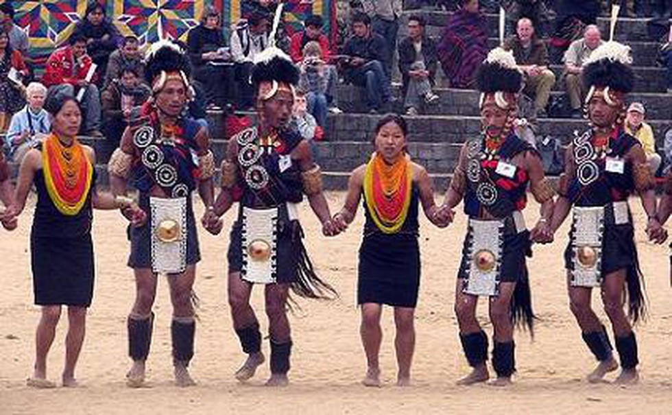
About Khiamniungan Tribe:
- The Khiamniungan tribe is one of the major tribes among the Nagas, with habitation both in India and Myanmar.
- Geographically, the land of Khiamniungans is located in the Eastern part of Nagaland and in the North-Western part of Myanmar.
- The nomenclature of the tribe ‘Khiamniungan’ is a compound word formed by three words: ‘Khiam’ means water, ‘Niu’ means great and ‘Ngan’ means source. Thus, the meaning of the term Khiamniungan is ‘source of great water or river’.
- According to the 2011 census, the total population of the Khiamniungan tribe in India is 61,983.
- Major Festivals:
- Tsokum is one of the most important and significant festivals which is celebrated with great pomp and gaity.
- Khaotzao Sey Hok-ah sumai (Festival) is another important festival of Khiamniungan Naga which marks the end of all agricultural activities for the year.
3. Key Facts about Kerch Strait
About Kerch Strait:
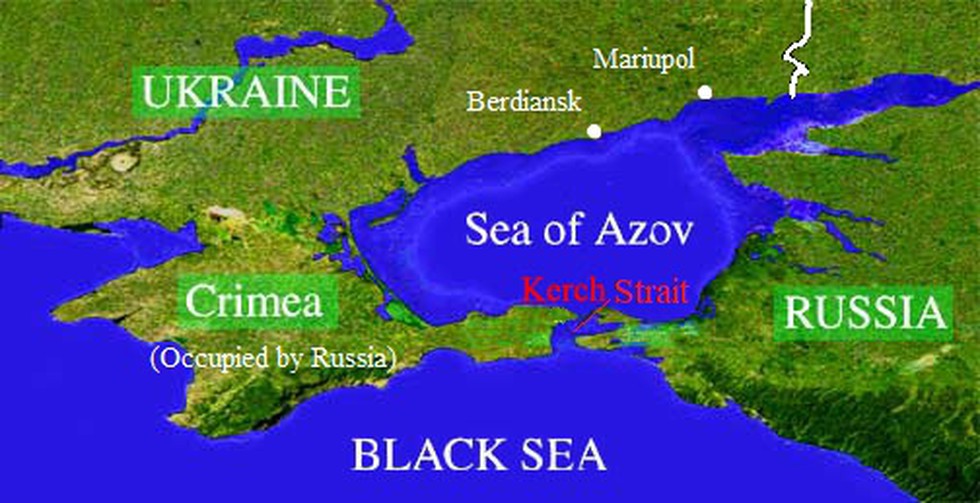
- The Kerch Strait is in Eastern Europe and is the only water body that connects the Black Sea with the Sea of Azov.
- The Romans called it the Strait of Cimmerian Bosphorus. In Greek, it was known as the Cimmerian strait.
- It separates the Kerch Peninsula (part of the Russian-occupied Crimean Peninsula) towards the west from the Taman Peninsula (Russia), lying in the east.
- It is about 3 km long, 15 km broad, and 18 metres deep.
- At its narrowest point, which lies at the northern end of the Chushka Land spit, it is only three to five kilometres wide.
- The city of Kerchlies near the middle of the strait, on the Crimean side.
- It is an important global shipping route, providing passage from the Sea of Azov to the Black Sea.
- It has also been a key point of conflict between Russia and Ukraine after Moscow annexed the peninsula from Ukraine in 2014.
- Kerch Strait Bridge:
- Also known as the Crimean Bridge, this infrastructure links mainland Russia with Crimea.
- Completed in 2018, it includes a road and rail connection and is the longest bridge in Europe at 19 km.
- It is a symbol of Russia's annexation of Crimea in 2014.
4. Key Facts about Golan Heights
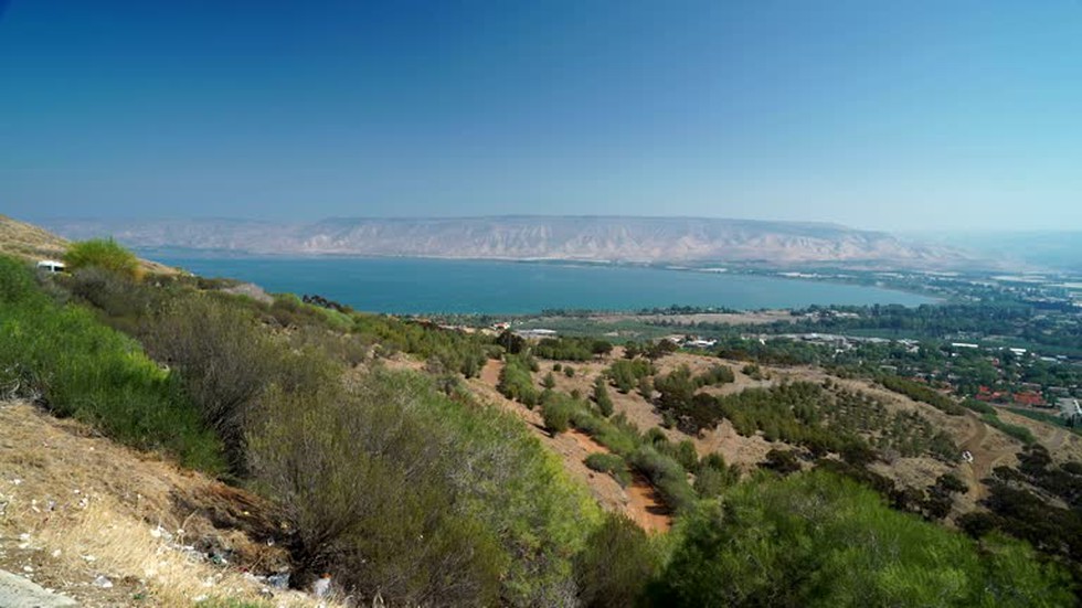
About Golan Heights:
- It is a hilly area overlooking the upper Jordan River valley on the west.
- It is a Syrian territory occupied by Israel since 1967.
- The area’s name is from the biblical city of refuge Golan in Bashan.
- It is bounded by the Jordan River and the Sea of Galileeon the west, Mount Hermon on the north, the seasonal Wadi Al-Ruqqād River on the east, and the Yarmūk River on the south.
- It extends about 71 km from north to south and about 43 km from east to west at its widest point.
- It is roughly boat-shaped and has an area of 1,150 sq.km.
- History:
- The area was part of extreme southwestern Syria until 1967 when it came under Israeli military occupation in the closing stages of the 1967 Six-Day War.
- Most of the Syrian Arab inhabitants fled the area during the conflict.
- Syria tried to retake the Golan Heights during the 1973 Middle East war, but the attempt was thwarted.
- Both countries signed an armistice in 1974, and a UN observer force has been in place on the ceasefire line since 1974.
- In December 1981, Israel unilaterally annexed the part of the Golan it held.
- It's considered occupied territory under international law and UN Security Council resolutions.
- There are more than 30 Israeli settlements in the Golan Heights, which are home to an estimated 20,000 people.
- They are considered illegal under international law, which Israel disputes.
- The settlers lived alongside some 20,000 Syrians, most of them Druze Arabs who did not flee when the area came under Israeli control.
- Strategic Importance:
- The Syrian capital, Damascus, can be clearly seen from the top of the Golan Hills.
- It overlooks northern Israel’s Galilee region and the Sea of Galilee and dominates the route to Damascus on the Syrian-controlled side.
- Importantly, the Golan Heights shares a border with Jordan and Lebanon.
- The area is also a key source of water for an arid region. Rainwater from the Golan's catchment feeds into the Jordan River.
5. What is Little Bunting?

About Little Bunting:
- It is a passerine bird belonging to the bunting family (Emberizidae).
- Scientific Name: Emberiza pusilla
- Distribution:
- It breeds across the taiga of the far northeast of Europeand northern Euro Siberia to the Russian Far East.
- It is migratory, wintering in the subtropics in northern India, southern China,and the northern parts of Southeast Asia.
- Features:
- This is a small bunting, measuring only 12–14 cm (4.7–5.5 in) in length.
- It has white underparts with dark streaking on the breast and sides.
- With its chestnut face and white malar stripe, it resembles a small female reed bunting but has black crown stripes, a white eye ring, and a fine dark border to the rear of its chestnut cheeks.
- The sexes are similar.
- The call is a distinctive zik, and the song is a rolling siroo-sir-sir-siroo.
- IUCN Red List: Least Concern
6. Santa Ana Wind

About Santa Ana Wind:
- It is named after Southern California's Santa Ana Canyon.
- Santa Ana winds are dry and warm (often hot) winds in the Southern California area that blow in from the desert -- which includes the Great Basin of the western United States.
- Origin: Santa Ana winds blow when high pressure builds over the Great Basin — the area between the Rocky Mountains and Sierra Nevada (a mountain range in the Western United States) — and the pressure is low over California’s coast.
- The difference in pressure triggers the movement of powerful winds from the Basin’s inland deserts, east and north of Southern California, over the mountains toward the Pacific Ocean.
- As the wind comes down the mountains, it compresses and heats up. The wind’s humidity also drops, sometimes to less than 20% or even less than 10%. The extremely low moisture turns vegetation dry, making it ready to burn.
- Winter weather patterns allow high pressure to build near the surface of the Great Basin, which then interacts with low-pressure air over the Pacific.
- Santa Ana winds usually occur from October to January.
7. Jalvahak Scheme
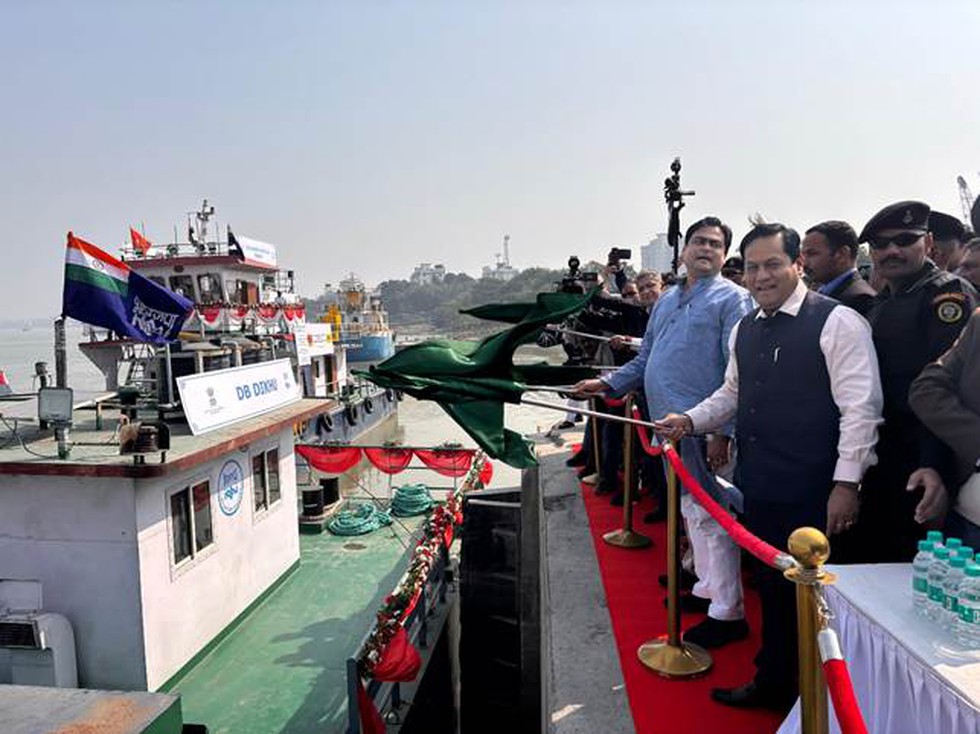
About Jalvahak Scheme:
- It aims to unlock the trade potential of inland waterways while reducing logistics costs and decongesting road and rail networks.
- Features
- Under the scheme, cargo owners transporting goods over distances exceeding 300 km via waterways will receive up to 35 per cent reimbursement on operating costs.
- The scheme will remain valid for three years and is designed to optimise supply chains for major shipping companies, freight forwarders, and trade bodies.
- It is a major step towards promoting sustainable and cost-effective transportation across National Waterways 1 (Ganga), 2 (Brahmaputra), and 16 (Barak river).
- The Jalvahak scheme incentivises long-haul cargo transport and ensures timely delivery through regular freight services.
- This marks the beginning of fixed Scheduled Service of Cargo Vessels from Haldia for NW 1 and NW 2.
- The Fixed Day Scheduled Sailing Service will ply vessels between the Kolkata - Patna - Varanasi - Patna - Kolkata stretch of NW 1 and between Kolkata and Pandu in Guwahati on NW 2 via Indo Bangladesh Protocol Route (IBPR).
- Implemented by: It is jointly implemented by the Inland Waterways Authority of India (IWAI) and Inland & Coastal Shipping Ltd (ICSL).
8. National Energy Conservation Award
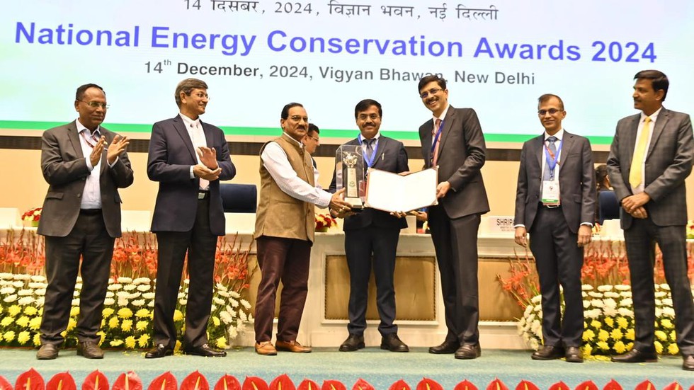
About National Energy Conservation Award:
- It is an initiative by the Bureau of Energy Efficiency (BEE) under the Ministry of Power.
- It was instituted in 1991, alongside the declaration of National Energy Conservation Day (December 14).
- These awards honour the exceptional efforts of industrial units, institutions, and establishments that have significantly reduced energy consumption while maintaining or enhancing their operational efficiency.
- Selection procedure
- The Award Committee, chaired by the Secretary (Power), reviews and approves the sectors eligible for the NECA.
- The applications submitted are evaluated by a Technical Committee, chaired by the Member (Thermal), Central Electricity Authority (CEA), and comprising representatives from the Ministry of Railways, Central Electricity Authority, Energy Efficiency Services Limited (EESL), National Productivity Council (NPC), Central Pulp and Paper Research Institute (CPPRI), and the Bureau of Energy Efficiency (BEE).
- Afterward, the Technical Committee's recommendations are submitted to the Award Committee for final consideration and approval.
- The selected awardees from various sectors are then honored and felicitated on National Energy Conservation Day
Key facts about the Bureau of Energy Efficiency
- It was established on 1st March 2002 under the provisions of the Energy Conservation Act, 2001.
- The mission of the Bureau is to assist in developing policies and strategies with a thrust on self-regulation and market principles.
- A key objective is reducing the energy intensity of the Indian economy.
- It coordinates with designated consumers, designated agencies and other organizations.
- It recognises, identifies and utilises the existing resources and infrastructure, in performing the functions assigned to it under the Act.
- The Act also provides for regulatory and promotional functions.
9. Humpback Whale
About Humpback Whale:
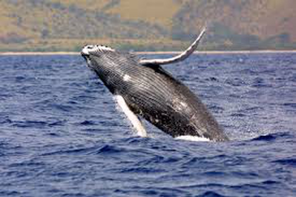
- The humpback whale gets its common name from the distinctive hump on its back. Its long pectoral fins inspired its scientific name, Megaptera, which means “big-winged”.
- Appearance:
- Humpback females are larger than males.
- They are mainly black or greywith white undersides to their flukes, flippers and bellies.
- They also have large knobs on the head, jaws, and body, each knob being associated with one or two hairs.
- Distribution: These whales live in all oceans around the world. They travel great distances every year and have one of the longest migrations of any mammal on the planet.
- They undertake long migrations between polar feeding grounds in summer and tropical or subtropical breeding grounds in winter.
- Humpbacks use a unique method of feeding called bubble netting, in which bubbles are exhaled as the whale swims in a spiral below a patch of water dense with food.
- Conservation status
- IUCN: Least concern
- CITES: Appendix I
10. Search and Rescue Aid Tool (SARAT)

About Search and Rescue Aid Tool:
- It was launched in 2016 for facilitating search and rescue operations in the seas to locate individuals/vessels in distress in the shortest possible time.
- This has been initiated and developed under the Make in India program and developed by the Indian National Centre for Ocean Information Services (INCOIS).
- Working
- The tool uses model ensembling that accounts for uncertainties in the initial location as well as the last known time of the missing object, to locate the person or object with high probability.
- The movements of the missing objects are governed mainly by the currents and winds.
- The tool is based on model currents derived from a very high-resolution Regional Ocean Modelling System run operationally on High-Performance Computers at INCOIS.
- The user has the option to select up to 60 types of missing objects (based on shape and buoyancy).
- Users can select a specific point where the object was last seen using the interactive map or they can also select a coastal location, distance travelled and bearing angle so that the last known location of the missing object is estimated.
- The results generated are displayed in an interactive map depicting the probable area to be searched and are also sent as text messages to emails/mobile phones.
- All the requests and responses are provided in the languages of the coastal states so that local fishermen can use them immediately to search for their fellow fishermen in distress.
- In SARAT version 2, the position from which the search area expands has now been corrected to be the last known position of the object.
- It further offers improved visualizations for a better judgement of a probable area of finding the missing object, colour coding of search regions, and a marker for easier identification of the last known position of the object.


.png)
.png)
.png)
.png)
.png)


.png)
.png)
.png)


.png)
.png)


.png)
.png)
.png)
.png)
.png)
.png)
.png)
.png)
.png)

.png)


.png)
.png)


.png)
.png)
.png)


.png)

.png)
.png)


.jpg)

.png)
.png)


.png)

.png)
.png)
.png)

.jpg)

.jpg)


.png)

.png)
.png)
.png)
.png)
.png)
.png)
.png)
.png)
.png)
.png)


.png)

.png)


.png)
.png)
.png)
.png)
.png)
.png)
.png)
.png)
.png)
.png)
.jpg)
.jpg)

.png)
.png)
.png)
.png)
.png)
.png)
.png)
.png)
.png)
.png)
.png)
.png)
.png)
.png)
.png)
.png)
.png)
.png)
.png)
.png)
.png)
.png)


.png)
.png)

.jpg)
.jpg)


.jpg)
.jpg)
.jpg)
.jpg)
.jpg)

.jpg)


.jpg)
.jpg)
.jpg)
.jpg)
.jpg)


.jpg)
.jpg)


.jpg)


.jpg)
.jpg)


.jpg)
.jpg)


.jpg)

.jpg)


.jpg)


.jpg)


.jpg)


.jpg)


.jpg)


.jpg)


.jpg)
.jpg)
.jpg)


.jpg)

.jpg)
.jpg)


.jpg)


.jpg)
.jpg)


.jpg)


.jpg)


.jpg)


.jpg)
.jpg)
.jpg)

.jpg)
.jpg)
.jpg)
.jpg)

.jpg)
.jpg)
.jpg)

.jpg)
.jpg)
.jpg)
.jpg)
.jpg)
.jpg)
.jpg)
.jpg)

.jpg)


.jpg)
.jpg)
.jpg)
.jpg)
.jpg)
.jpg)
.jpg)
.jpg)
.jpg)
.jpg)


.jpg)
.jpg)


.jpg)
.jpg)
.jpg)


.jpg)


.jpg)


.jpg)
.jpg)


.jpg)
.jpg)


.jpg)
.jpg)
.jpg)
.jpg)
.jpg)

.jpg)
.jpg)
.jpg)
.jpg)
.jpg)


.jpg)
.jpg)
.jpg)
.jpg)
.jpg)

.jpg)
.jpg)
.jpg)
.jpg)
.jpg)
.jpg)
.jpg)
.jpg)
.jpg)
.jpg)
.png)

.png)
.png)

.png)
.png)
.png)
.png)


.jpg)
.jpg)

.jpg)
.jpg)
.jpg)

.png)
.png)
.png)
.png)
.png)
.png)
.png)

.png)
.png)
.png)
.png)
.png)
.png)
.png)
.png)
.png)
.png)


-min.png)


.png)


.png)


