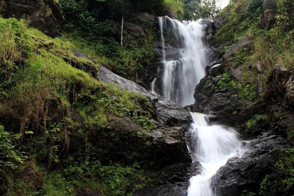
About Lakshmana Tirtha River:
- It is a tributary of the river Kaveri in Karnataka. It originates in the Brahmagiri hills, Kodagu or Coorg District, Karnataka, and flows eastward. It joins the Kaveri River in the Krishna Raja Sagara Lake.
- Lakshmanatirtha Falls, or the Irupu Falls, is a much-visited fresh water cascade located on the river, bordering Kerala, on the way to Nagerhole National Park.
Key Facts about Kaveri River:
- It rises at an elevation of 1,341 m at Talakaveri on the Brahmagiri range near Cherangala village of Kodagu district of Karnataka.
- It drains into the Bay of Bengal at Poompuhar, in the Mayiladuthurai district of Tamil Nadu.
- Cauvery Basin:
- It extends over the states of Tamil Nadu, Karnataka, Kerala and Union Territory of Puducherry.
- It is bounded by the Western Ghats on the west, by the Eastern Ghats on the east and south and by the ridges separating it from the Krishna basin and Pennar basin on the north.
- Major left bank tributaries: Harangi, the Hemavati, the Shimsha, and the Arkavati.
- Major right bank tributaries: Lakshmantirtha, the Kabbani, the Suvarnavati, the Bhavani, the Noyil, and the Amaravati.
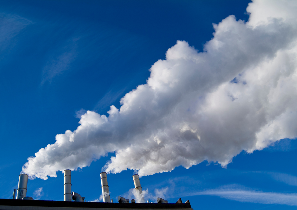
About Global Alliance for Incinerator Alternatives (GAIA):
- It is a worldwide alliance of more than 1,000 grassroots groups, non-governmental organizations and individuals. It aims to power a transition away from our current linear and extractive economy and towards a circular system that supports people’s right to a safe and healthy environment.
- It envisions a just, zero-waste world built on respect for ecological limits and community rights, where people are free from the burden of toxic pollution and resources are sustainably conserved, not burned or dumped.
- This entails fighting pollution and building regenerative solutions in cities through local campaigns, shifts in policy and finance, research and communication initiatives, and movement building.
- They work on four primary points of intervention: incineration, zero waste, plastic, and climate.
What is Incineration?
- Incineration is the process of burning hazardous materials at temperatures high enough to destroy contaminants.
- Incineration is conducted in an “incinerator,” which is a type of furnace designed for burning hazardous materials in a combustion chamber.
- Many different types of hazardous materials can be treated by incineration, including soil, sludge, liquids and gases.
- Although it destroys many kinds of harmful chemicals, such as solvents, PCBs (polychlorinated biphenyls) and pesticides, incineration does not destroy metals, such as lead and chromium.
- Modern incinerators include air pollution control equipment (e.g., fabric filters, scrubbers and electrostatic precipitators) to remove fly ash and gaseous contaminants.

About Gross Fixed Capital Formation (GFCF):
- It refers to the growth in the size of fixed capital in an economy. Fixed assets/capital are tangible or intangible assets produced as outputs from production processes that are used repeatedly or continuously, for more than one year.
- It consists of resident producers’ investments, deducting disposals, in fixed assets during a given period. It also includes certain additions to the value of non-produced assets realized by producers or institutional units.
- Private GFCF can serve as a rough indicator of how much the private sector is willing to invest. Overall GFCF also includes capital formation as a result of investment by the government.
- It matters because fixed capital, by helping workers produce a greater amount of goods and services each year, helps to boost economic growth and improve living standards.
- In other words, fixed capital is what largely determines the overall output of an economy and, hence, what consumers can actually purchase in the market.
- Developed economies such as the U.S. possess more fixed capital per capita than developing economies such as India.
- Statistics:
- GFCF in the Indian economy increased significantly from INR 32.78 lakh crore in 2014-15 to INR 54.35 lakh crore in 2022-2023.
- This surge in capital formation reflects substantial investments in infrastructure, industry, and public goods.
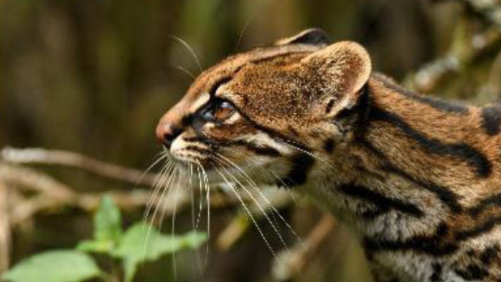
What are Tiger Cats?
- Tiger, also known as the oncilla, cats are small spotted cats that quietly stalk Central and South America, perfectly adapted for clambering in trees and hunting small prey.
- They are among the shyest and smallest wild cats in the Americas and much smaller than most domestic house cats.
- Until recently, they were split into two species: the northern tiger cat (Leopardus tigrinus), and the Atlantic Forest tiger cat(Leopardus guttulus).
- The northern tiger cat is native to the savanna and shrublands of the Guiana Shield and central Brazil, while the Atlantic tiger cat lives further south in forested areas of central to southern Brazil, down through Paraguay and northeastern Argentina.
- Researchers recently concluded that the family includes a third species: the clouded tiger cat (Leopardus pardinoides).
About Clouded Tiger Cat:
- It is a new species of forest-dwelling tiger cat. Its scientific name is Leopardus pardinoides
- Geographic Distribution: It is found in the cloud forests of the southern Central American and Andean Mountain chains, which stretch from Costa Rica through Panama, Colombia, Peru, Bolivia, and Argentina.
- Features:
- It is a long-tailed cat with short-round ears, weighing 2.27 kg.
- It has a remarkably margay-looking head, which has a nice dense soft fur of a rich reddish/orangish/grayish-yellow background color adorned with irregularly shaped medium-large ‘cloudy’ rosettes that are strongly marked and often coalesce.
- Distinctively, it has only one pair of mammae/teats.
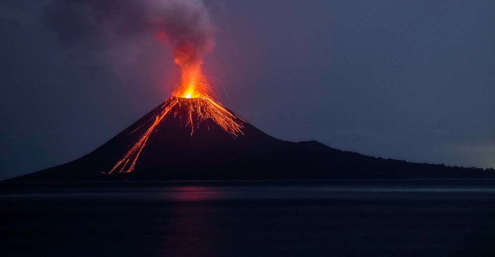
About Mount Ruang:
- It is a stratovolcano located in Indonesia’s North Sulawesi province. Its summit stands 10,932 feet above sea level, with a caldera that is about two miles wide.
What is a Stratovolcano?
- It is a tall, steep and cone-shaped type of volcano. Unlike flat shield volcanoes, they have higher peaks.
- They are typically found above subduction zones, and they are often part of large volcanically active regions, such as the Ring of Fire that frames much of the Pacific Ocean.
- It comprises the largest percentage (~60%) of the Earth's individual volcanoes, and most are characterized by eruptions of andesite and dacite, lavas that are cooler and more viscous than basalt.
- These more viscous lavas allow gas pressures to build up to high levels. Therefore, these volcanoes often suffer explosive eruptions.
- They are usually about half-half lava and pyroclastic material and the layering of these products gives them their other common name of composite volcanoes.
- At the peak, stratovolcanoes usually have a small crater. The crater may be filled with water or ice, or it may contain a volcanic dome during a period of relative inactivity.

About Palestine:
- Location:
- It is located in Western Asia. The Palestinian territories are made up of the areas known as Gaza and the West Bank. Both of which are ruled over and controlled by different governments.
- It is geographically positioned both in the Northern and Eastern hemispheres of the Earth.
- The Gaza Strip is bordered by the Mediterranean Sea to the west; by Egypt on the southwest and by Israel on the east and north.
- The West Bank is bordered by Israel in the north, south, and west; and by Jordan and the Dead Sea in the east.
- The Jordan River is the most significant geographical feature in Palestine. The river runs north to south from the Sea of Galilee to the Dead Sea.
- The highest point in Palestine can be found within the West Bank at Mount Nabi Yunis at an elevation of 3,379ft.
- Climate: The climate in both Gaza and the West Bank can be roughly described as Mediterranean with Gaza being slightly hotter and drier than those in the West Bank.
- The eastern border with Jordan also tends to be hotter than average and experiences a considerably less amount of rainfall throughout the year.
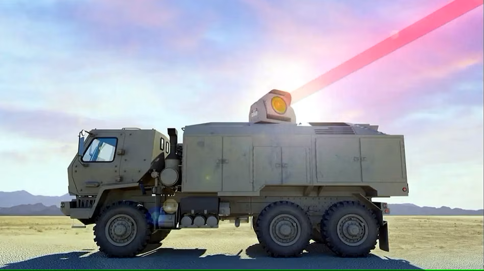
About DURGA-2:
- It damages or destroys its target using focused energy by means of lasers, microwaves or particle beams.
- Advantages: These weapons have several advantages over conventional munitions.
- They transmit lethal force at the speed of light (about 300,000 kilometers per second).
- Their beams are not affected by the constraining effects of gravity or atmospheric drag.
- They are extremely precise. Fourth, their effects can be tailored by varying the type and intensity of energy delivered against targets.
- Significance
- The aerospace industry can transform the way wars will be fought.
- This will enable us to produce cutting edge platforms, weapons, sensors, and networks essential to fight and win a future war.
- Other countries which have this system: Russia, France, Germany, the United Kingdom, Israel, and China.
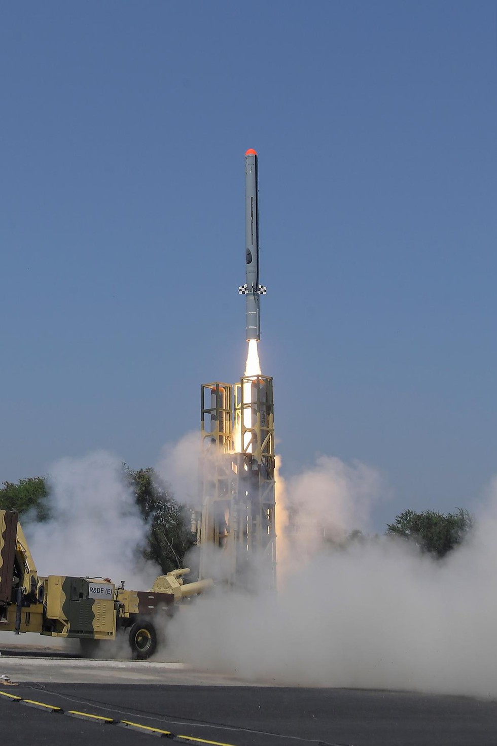
About Indigenous technology cruise missile:
- It is equipped with advanced avionics and software to ensure better and reliable performance.
- It is developed by Bengaluru-based DRDO laboratory Aeronautical Development Establishment (ADE) along with contribution from other laboratories and Indian industries.
- It was monitored by several range sensors like radar, Electro Optical Tracking System (EOTS) and telemetry deployed by ITR at different locations to ensure complete coverage of the flight path.
What is a Cruise missile?
- It is a guided missile used against terrestrial or naval targets, that remains in the atmosphere (unlike ballistic missiles) and flies the major portion of its flight path at an approximately constant speed, before hitting the target.
- Precision: High, up to a few metres — fit for small, moving targets.
- Trajectory: Low altitude, level trajectory — hard to detect
- Subsonic Cruise missiles: These cruise missiles travel at less than Mach 1.
- Supersonic Cruise missiles: Cruise missiles travelling at supersonic speeds are called supersonic cruise missiles.
- Hypersonic Cruise missiles: Cruise missiles powered using scramjet engines to realise speeds greater than Mach 5 are designated as hypersonic cruise missiles.
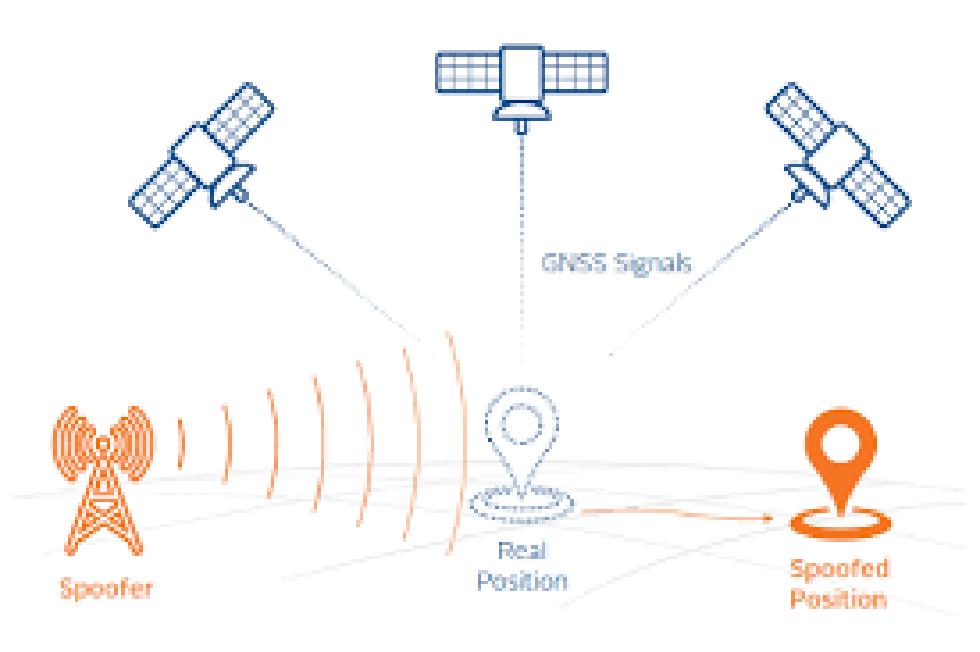
About GPS spoofing:
- It is also known as GPS simulation, refers to the practice of manipulating or tricking a GPS receiver by broadcasting false GPS signals.
- It misleads the GPS receiver into believing it is located somewhere it is not, resulting in the device providing inaccurate location data. This form of cyberattack undermines the reliability of GPS data, which is vital for a variety of applications.
- It has evolved significantly over the years. Initially a theoretical threat, it has now become a practical concern due to the availability of inexpensive software and hardware capable of transmitting fake GPS signals.
- Spoofing is not the same as jamming. While jamming, as the name suggests, is when the GPS signals are jammed, spoofing is very different and way more threatening.
- Planes and other aircraft regularly deal with jamming while spoofing of the kind happening in the above-mentioned incidents has reportedly never been seen before.
- Working
- GPS spoofing exploits the inherent vulnerabilities in the GPS infrastructure – the weak signal strength of GPS satellites.
- The Global Positioning System functions by sending signals from satellites to GPS receivers on Earth.
- These receivers then calculate their position based on the time it takes for these signals to arrive. However, due to the weak signal strength of the GPS satellites, these signals can be easily overwhelmed by fake signals, resulting in inaccurate location data on the receiving device.
- Impacts
- It can have potentially catastrophic effects, particularly where navigation is concerned.
- It has the potential to affect various industries extensively, including logistics and supply chain, telecommunications, energy, and defense.
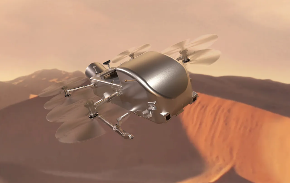
About Dragonfly Mission:
- It is a "dual quadcopter" designed to fly across the surface of Titan, Saturn's largest moon. It will explore a variety of locations on Saturn's moon Titan.
- It will spend most of its time on the moon’s surface making science measurements. It will use a radioisotope power system like the Curiosity rover on Mars.
- Its flights, data transmission and most science operations will happen during the day, and it will have a lot of time to recharge during night on Titan.
- It is a rotorcraft, targeted to arrive at Titan in 2034, will fly to dozens of promising locations on the moon, looking for prebiotic chemical processes common on both Titan and the early Earth before life developed.
- It marks the first time NASA will fly a vehicle for science on another planetary body. The rotorcraft has eight rotors and flies like a large drone.
Key facts about Titan
- Titan is Saturn’s largest moon, Titan has an earthlike cycle of liquids flowing across its surface. It is the only moon with a thick atmosphere.


.png)
.png)
.png)
.png)
.png)


.png)
.png)
.png)


.png)
.png)


.png)
.png)
.png)
.png)
.png)
.png)
.png)
.png)
.png)

.png)


.png)
.png)


.png)
.png)
.png)


.png)

.png)
.png)


.jpg)

.png)
.png)


.png)

.png)
.png)
.png)

.jpg)

.jpg)


.png)

.png)
.png)
.png)
.png)
.png)
.png)
.png)
.png)
.png)
.png)


.png)

.png)


.png)
.png)
.png)
.png)
.png)
.png)
.png)
.png)
.png)
.png)
.jpg)
.jpg)

.png)
.png)
.png)
.png)
.png)
.png)
.png)
.png)
.png)
.png)
.png)
.png)
.png)
.png)
.png)
.png)
.png)
.png)
.png)
.png)
.png)
.png)


.png)
.png)

.jpg)
.jpg)


.jpg)
.jpg)
.jpg)
.jpg)
.jpg)

.jpg)


.jpg)
.jpg)
.jpg)
.jpg)
.jpg)


.jpg)
.jpg)


.jpg)


.jpg)
.jpg)


.jpg)
.jpg)


.jpg)

.jpg)


.jpg)


.jpg)


.jpg)


.jpg)


.jpg)


.jpg)


.jpg)
.jpg)
.jpg)


.jpg)

.jpg)
.jpg)


.jpg)


.jpg)
.jpg)


.jpg)


.jpg)


.jpg)


.jpg)
.jpg)
.jpg)

.jpg)
.jpg)
.jpg)
.jpg)

.jpg)
.jpg)
.jpg)

.jpg)
.jpg)
.jpg)
.jpg)
.jpg)
.jpg)
.jpg)
.jpg)

.jpg)


.jpg)
.jpg)
.jpg)
.jpg)
.jpg)
.jpg)
.jpg)
.jpg)
.jpg)
.jpg)


.jpg)
.jpg)


.jpg)
.jpg)
.jpg)


.jpg)


.jpg)


.jpg)
.jpg)


.jpg)
.jpg)


.jpg)
.jpg)
.jpg)
.jpg)
.jpg)

.jpg)
.jpg)
.jpg)
.jpg)
.jpg)


.jpg)
.jpg)
.jpg)
.jpg)
.jpg)

.jpg)
.jpg)
.jpg)
.jpg)
.jpg)
.jpg)
.jpg)
.jpg)
.jpg)
.jpg)
.png)

.png)
.png)

.png)
.png)
.png)
.png)


.jpg)
.jpg)

.jpg)
.jpg)
.jpg)

.png)
.png)
.png)
.png)
.png)
.png)
.png)

.png)
.png)
.png)
.png)
.png)
.png)
.png)
.png)
.png)
.png)


-min.png)


.png)


.png)


